• Link to LinkedIn
  • Link to Youtube
  • Link to Facebook
  • Link to Instagram
  • Link to X
  • Link to Telegram
  • Link to Behance
  • Link to Rss this site
  • Link to Mail
  • NEWS
  • EVENTS
  • JOBS
  • MEMBER
  • Sitemap
    • Home
      • NEWS
      • EVENTS
      • JOBS
      • MEMBERSHIP
    • ⭐ About Geodesy
    • 🏛️ IAG | International Association of Geodesy
      • About IAG
      • Structure
      • 🎓 ECS – Early Career Scientists
      • 🌈 IDEA – Inclusion, Diversity, Equity, Accessibility
    •   └─ Comissions
      • 1️⃣ Reference Frames
      • 2️⃣ Gravity Field
      • 3️⃣ Earth Rotation & Geodynamics
      • 4️⃣ Positioning & Applications
    •   └─ Inter Commission Committees
      • 📚 ICCT – Theory
      • 🌊 ICCM – Marine Research
      • 🌥️ ICCC – Climate Research
    •   └─ Project QuGe
    •   └─ Services
    • 🌍 GGOS | Global Geodetic Observing System
      • About GGOS
      • Structure
      • 🛰️ Observations
      • 📦 Products
      • ⚙️ Services
  • Shopping Cart Shopping Cart
    0Shopping Cart
geodesy.science - IAG website
  • News
    • Home
      • NEWS
      • EVENTS
      • JOBS
      • MEMBERSHIP
    • ⭐ About Geodesy
    • 🏛️ IAG | International Association of Geodesy
      • About IAG
      • Structure
      • 🎓 ECS – Early Career Scientists
      • 🌈 IDEA – Inclusion, Diversity, Equity, Accessibility
    •   └─ Comissions
      • 1️⃣ Reference Frames
      • 2️⃣ Gravity Field
      • 3️⃣ Earth Rotation & Geodynamics
      • 4️⃣ Positioning & Applications
    •   └─ Inter Commission Committees
      • 📚 ICCT – Theory
      • 🌊 ICCM – Marine Research
      • 🌥️ ICCC – Climate Research
    •   └─ Project QuGe
    •   └─ Services
    • 🌍 GGOS | Global Geodetic Observing System
      • About GGOS
      • Structure
      • 🛰️ Observations
      • 📦 Products
      • ⚙️ Services
  • News
    • ALL News
    • 📰 General News
    • 🌍 Geodesy News
    • 📅 Event Update
    • 🏛️ Organisation News
  • Mailing List
  • IAG Newsletter
  • Social Media
  • Post Your News
  • Click to open the search input field Click to open the search input field Search
You are here: Home1 / IAG2 / Geodesy Day – International Webinar on Geodesy

Geodesy Day – International Webinar on Geodesy

IAG, IUGG, 📅 Event Update

“Every map ever drawn. Every satellite ever launched. Every border ever defined. All rest upon one science…

Geodesy”

About the Event

What if the science that holds our modern world together remains largely invisible to those who need it the most? Survey of Pakistan (SoP) is determined to change that.

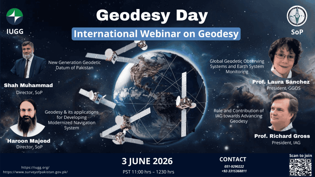
On 3 June 2026, Survey of Pakistan will proudly observe National Geodesy Day in Pakistan – which will become a permanent observance every year. This event on 3 June is a landmark initiative to bring Geodesy out of the shadows and into the spotlight it deserves. In the spirit of the International Union of Geodesy and Geophysics (IUGG) and the International Association of Geodesy (IAG), this international webinar unites brilliant minds from across the globe to celebrate, advance and reimagine the future of geodetic sciences.

Why This Moment Matters?

We live in an era of climate change, rapid urbanization, satellite navigation and digital mapping – all underpinned by the precision of Geodesy. In Pakistan, however, the field continues to face institutional challenges, including limited academic recognition and the absence of dedicated university level degree programs. National Geodesy Day is a strategic initiative to address these gaps, stimulate scientific discourse and align national efforts with international geodetic standards and priorities.

Objectives

  1. Promote awareness of Geodesy in Pakistan and its scientific significance within the framework of IUGG and IAG goals
  2. Facilitate international exchange of knowledge on modern geodetic methods, technologies and applications
  3. Strengthen scientific cooperation between Pakistan and the global geodetic community
  4. To promote geodetic education and research programs at the national level
  5. Contribute to the advancement of geodetic sciences at regional and global levels in support of IUGG’s mission

Who Should Attend

This webinar is open to all experts, researchers, academics, geospatial professionals and students with an interest in geodesy, surveying, remote sensing and related disciplines.


Be Part of Something Significant

National Geodesy Day is not a mere webinar, it is a meaningful step toward strengthening Pakistan’s engagement with the global geodetic community. We invite international experts, researchers and professionals to join us, share expertise and help shape Pakistan’s path towards joining more scientifically connected world.

To Join the Session

Platform:        Zoom

Join Link:       https://us06web.zoom.us/j/88311296173

Meeting ID:    883 1129 6173

“No registration required. Simply click the link on 3 June 2026 and join the session at 11AM (Pakistan Standard Time)”


Hosted by

Survey of Pakistan (SoP), National Geospatial Agency of Pakistan

Author: Junaid Memon (Member of IUGG)

https://geodesy.science/wp-content/uploads/EVENT_POSTER_Copyright-JunaidMemon_2026-05-21_b2c478.pdf

https://geodesy.science/wp-content/uploads/EVENT_POSTER_Copyright-SurveyofPakistan_2026-05-21_e7317a.pdf

https://geodesy.science/wp-content/uploads/EVENT_POSTER_Copyright-SurveyofPakistan_2026-05-21_74f73d.pdf

📰 Subscribe to "IAG Updates" Mailing List

Get monthly updates on 📰 News, 📅 Events & 💼 Job offers.

No spam! Unsubscribe anytime. By signing up, you agree to our terms.

Also, explore other mailing lists or follow us on social media.

Check your inbox or spam folder to confirm your subscription.

May 21, 2026
May 21, 2026
Share this entry
  • Facebook Facebook Share on Facebook
  • X-twitter X-twitter Share on X
  • Whatsapp Whatsapp Share on WhatsApp
  • Pinterest Pinterest Share on Pinterest
  • Linkedin Linkedin Share on LinkedIn
  • Mail Mail Share by Mail
https://geodesy.science/wp-content/uploads/eventNews1_AdobeStock_238163501.jpeg 1004 1504 admin https://geodesy.science/wp-content/uploads/IAG-logo-web.png admin2026-05-21 12:57:542026-05-21 12:57:54Geodesy Day – International Webinar on Geodesy
📰 NEWS

└─ 📰 General News

└─ 🌍 Geodesy News

└─ 🏛️ Organisation News

└─ 📅 Event Update

📢 Latest News

  • Geodesy Day – International Webinar on Geodesy
  • Geodetic Data: Applying FAIR, TRUST and CARE Principles
  • Geodesy Cartoons – Free Resources for Education and Outreach
  • NSL
    Professor Vidal Ashkenazi OBE – Obituary
  • Global Terrestrial Water Storage Anomaly Dataset Now Operationally Available via Copernicus

✉️ Get Updates Regularly

Mailing List Subscription

Select the list(s) you'd like updates from:

No spam! Unsubscribe anytime. By signing up, you agree to our terms.

Thank you for subscribing! Please check your inbox or spam folder to confirm.

IAG as part of the IUGG

  
The International Association of Geodesy (IAG)  is a constituent association of the International Union of Geodesy and Geophysics (IUGG).

IAG Related Organisations

IAG collaborates closely with numerous organizations within geodesy and beyond. See the list for details.

Sitemap

  • Home | geodesy.science
  • ⠀└─ 📰News
  • ⠀└─ 📅 Events
  • ⠀└─ 💼 Jobs
  • ⠀└─ 👥 Membership
  • ⭐ About Geodesy
  • 🏛️ IAG | Int. Association of Geodesy
  • ⠀└─ ➡️ Commissions:
  • ⠀⠀◻️ 1 – Reference Frames
  • ⠀⠀◻️ 2 – Gravity Field
  • ⠀⠀◻️ 3 – Earth Rotation & Geodynamics
  • ⠀⠀◻️ 4 – Positioning and Applications
  • ⠀└─ 🔀 Inter Commission Committees:
  • ⠀⠀◻️ ICCT – Theory
  • ⠀⠀◻️ ICCM – Marine Research
  • ⠀⠀◻️ ICCC – Climate Research
  • ⠀└─ ⏰ Project QuGe
  • ⠀└─ ⚙️ IAG Services
  •  🌎 GGOS | Observing System
  • ⠀└─ About GGOS
  • ⠀└─ Structure
  • ⠀└─ Observations
  • ⠀└─ Products
  • ⠀└─ Services

References

Geodesy Glossary

Media Library

IAG Cloud | Public Documents

Terms of Use / Privacy Policy

IAG Statutes

IAG By-laws

Contact Us

Contact

Follow Us

LinkedIn

BlueSky

X (Twitter)

Facebook

Instagram

YouTube

Telegram

RSS Feed

Mailing List

This website is provided by the IAG Secretariat and the GGOS Coordinating Office, which are hosted by the BEV – Federal Office of Metrology and Surveying (Bundesamt für Eich- und Vermessungswesen) in Vienna, Austria.

Website Language Translation

The primary language of this website is English – however, the integrated GTranslate tool enables automatic translation into several languages:

Please note that translations into other languages may not be accurate. For reliable information, refer to the English version of the website.

2026 © Copyright | IAG - International Association of Geodesy
  • Link to LinkedIn
  • Link to Youtube
  • Link to Facebook
  • Link to Instagram
  • Link to X
  • Link to Telegram
  • Link to Behance
  • Link to Rss this site
  • Link to Mail
Scroll to top Scroll to top Scroll to top
Accessibility Adjustments

Powered by OneTap

How long do you want to hide the toolbar?
Hide Toolbar Duration
Select your accessibility profile
Vision Impaired Mode
Enhances website's visuals
Seizure Safe Profile
Clear flashes & reduces color
ADHD Friendly Mode
Focused browsing, distraction-free
Blindness Mode
Reduces distractions, improves focus
Epilepsy Safe Mode
Dims colors and stops blinking
Content Modules
Font Size

Default

Line Height

Default

Color Modules
Orientation Modules