


 https://geodesy.science/wp-content/uploads/GeodesyCartoon_SLRstation_EN_v1-scaled.jpg
2048
1845
admin
https://geodesy.science/wp-content/uploads/IAG-logo-web.png
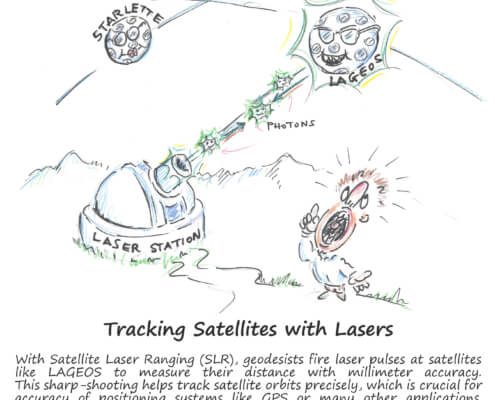
admin2025-08-26 10:44:152025-08-20 11:00:06Satellite Laser Ranging – How SLR Powers Geodesy
https://geodesy.science/wp-content/uploads/GeodesyCartoon_SLRstation_EN_v1-scaled.jpg
2048
1845
admin
https://geodesy.science/wp-content/uploads/IAG-logo-web.png
admin2025-08-26 10:44:152025-08-20 11:00:06Satellite Laser Ranging – How SLR Powers Geodesy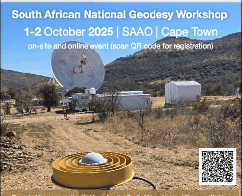 https://geodesy.science/wp-content/uploads/SAGWG_Copyright-AlethadeWittDSTI_2025-08-22.png
839
672
admin
https://geodesy.science/wp-content/uploads/IAG-logo-web.png
admin2025-08-25 12:50:102025-08-25 12:50:10South African National Geodesy Workshop
https://geodesy.science/wp-content/uploads/SAGWG_Copyright-AlethadeWittDSTI_2025-08-22.png
839
672
admin
https://geodesy.science/wp-content/uploads/IAG-logo-web.png
admin2025-08-25 12:50:102025-08-25 12:50:10South African National Geodesy Workshop https://geodesy.science/wp-content/uploads/iugg_iag_funding_support_sponsor_money_AdobeStock_290925022-1.jpeg
1040
1560
admin
https://geodesy.science/wp-content/uploads/IAG-logo-web.png
admin2025-08-21 09:00:372025-08-20 11:24:06Call for IAG proposals – IUGG Support Program of Scientific Meetings in 2026
https://geodesy.science/wp-content/uploads/iugg_iag_funding_support_sponsor_money_AdobeStock_290925022-1.jpeg
1040
1560
admin
https://geodesy.science/wp-content/uploads/IAG-logo-web.png
admin2025-08-21 09:00:372025-08-20 11:24:06Call for IAG proposals – IUGG Support Program of Scientific Meetings in 2026 https://geodesy.science/wp-content/uploads/IAG_SA2025_Rimini_GGOS.png
394
716
admin
https://geodesy.science/wp-content/uploads/IAG-logo-web.png
admin2025-08-19 10:37:392025-09-16 14:59:54GGOS Days 2025 – Invitation
https://geodesy.science/wp-content/uploads/IAG_SA2025_Rimini_GGOS.png
394
716
admin
https://geodesy.science/wp-content/uploads/IAG-logo-web.png
admin2025-08-19 10:37:392025-09-16 14:59:54GGOS Days 2025 – Invitation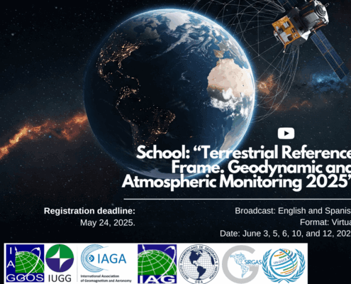 https://geodesy.science/wp-content/uploads/VirtualGeodesySchool2025_EN_edited-1.png
1112
1478
admin
https://geodesy.science/wp-content/uploads/IAG-logo-web.png
admin2025-07-21 11:00:582025-07-22 21:13:35Geodesy Virtual School 2025 – Summary
https://geodesy.science/wp-content/uploads/VirtualGeodesySchool2025_EN_edited-1.png
1112
1478
admin
https://geodesy.science/wp-content/uploads/IAG-logo-web.png
admin2025-07-21 11:00:582025-07-22 21:13:35Geodesy Virtual School 2025 – Summary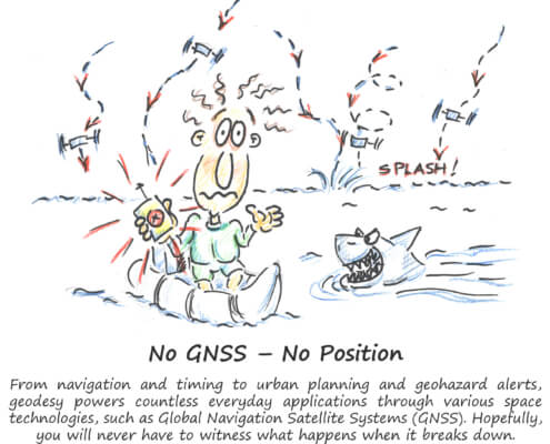 https://geodesy.science/wp-content/uploads/GeodesyCartoon_LostWithoutGeodesy_EN_v1.1-scaled.jpg
2048
1937
Martin Sehnal
https://geodesy.science/wp-content/uploads/IAG-logo-web.png
Martin Sehnal2025-07-21 09:00:202025-07-21 11:30:32Lost Without Geodesy
https://geodesy.science/wp-content/uploads/GeodesyCartoon_LostWithoutGeodesy_EN_v1.1-scaled.jpg
2048
1937
Martin Sehnal
https://geodesy.science/wp-content/uploads/IAG-logo-web.png
Martin Sehnal2025-07-21 09:00:202025-07-21 11:30:32Lost Without Geodesy
