GGOS-Portal

Idea of a Unique Platform for Geodetic Data and Products

The services of the International Association of Geodesy (IAG) provide very important and valuable geodetic data, information, and data products that are increasingly relevant for Earth System research, including monitoring of global change phenomena and a wide range of diverse applications such as satellite navigation, surveying, mapping, engineering, geospatial information systems, and so on.

Currently, it is difficult for many people to obtain an overview of all available geodetic products and data. The Global Geodetic Observing System (GGOS) of the IAG aims to fill this gap by developing the GGOS-Portal, which will serve as a unique search and access point for geodetic data and products (one-stop shop). Data and products will be described by detailed metadata and remain physically located at their originating data centers of each contributing IAG service and other data providers. The GGOS-Portal will only synchronize the provided metadata and include it in its platform to ensure better discoverability. In the long term, the GGOS-Portal can provide a set of tools for organized knowledge search, including visualization to support identification and selection of appropriate resources (information, data, products).

In general, geodetic data portals are a dime a dozen. However, the GGOS portal will be much more than just a data portal for geodetic data from the IAG Services. The combination of the easy understandable descriptions of products and observation techniques with this comprehensive source of detailed geodetic metadata makes the future GGOS portal unique.

Prominent examples for existing Metadata Portals are the GEOSS-Portal, the GNSS Metadata Portal Europe, the EPOS: GNSS Product Portal Europe and the Metadata Information System at BKG, Germany.
GGOS Portal

Community Survey

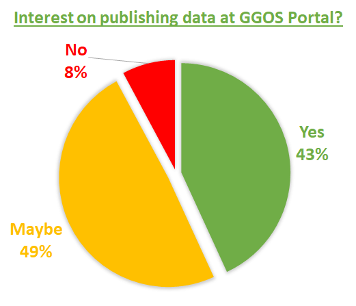
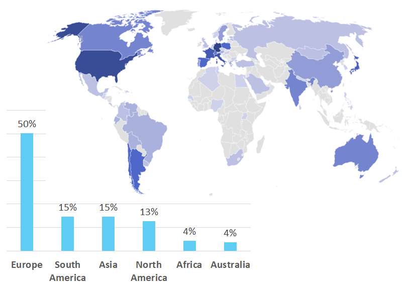
GGOS conducted a survey in April and March 2023 to inquire the opinions of geodetic data users on data availability and visibility and to identify requirements for a comprehensive and user-friendly GGOS Portal. In addition GGOS obtained an overview of the current availability of data products and their metadata.

195

participants from

57

countries

GGOS Portal Survey Result

Survey Results

All results of this community survey are published here:

SURVEY RESULTS [PDF] (DOI: 10.5281/zenodo.8113241)

In addition the final results of this survey was presented at the IUGG General Assembly 2023 and the GGOS Days 2023.

Feasability Study

Several software packages are available for the realization of such a metadata platform like the GGOS Portal. Two of them are particularly suitable for this purpose: GeoNetwork and CKAN. A requirements profile for the GGOS Portal was created based on the community survey conducted in spring 2023 and was then compared with the tested functionalities of the two software packages. A particular focus was on testing the metadata harvesting function. This feasability study is done by Lena Steiner from the Technical University in Vienna.

Bachelor Thesis: Steiner, L. (2023). Feasibility study for the development of a metadata web portal for geodetic data of the Global Geodetic Observing System. DOI

Presentation “Future Geodetic Data Platform: GGOS Portal Overview” – Martin Sehnal – GGOS Days 2024 – PDF File

What is Metadata & DOI’s for Geodetic Data?

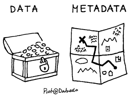
Metadata is data that provides information about the actual data, but not its content.

How does Metadata look like?

Metadata of geodetic data and products can contain several types of information. That can consist of general descriptions like title, data format, version, date, link to the data, contact person, … and of detailed descriptions like antenna type, receiver type, analyzing method, used models, …

What are Metadata Standards?

To make metadata comparable it is beneficial to use common metadata standards / schemas such as a simple Sitelog, GeodesyML, ISO19115, Dublin Core Format, etc.

How can Metadata be provided?

Geodetic metadata can be made available in the internet via various ways:

  • That could be a simple website where the geodetic data is described. In this case it is favorable to provide the metadata in a machine-readable format (e.g. XML or JSON). This is used, for example, for DOI metadata or GeodesyML.
  • Another way is to provide a metadata file (e.g. *.txt, *.log, Sitelog, …) on a server which can be accessed via (S)FTP or HTTP(S) request.
  • A provison of metadata by standardized Interfaces or API is also possible. There are several standards in use (e.g. OAI-PMH interface, RESTful interface, OGC web feature service, …). This allows easy synchronization (harvesting) of metadata for metadata portals like the GGOS Portal.
What are DOI’s for Geodetic Data?

To make geodetic data and products FAIR (Findable, Accessible, Interoperable and Reusable) it is advantageous to assign DOI (Digital Object Identifier) for them (e.g. http://doi.org/10.5880/ICGEM.2019.011). This allows citability and scientific recognition.

Looking more closely at DOIs for geodetic data, they consists of metadata provided in a standardized metadata schema and available on a website (landing page) that is also machine-readable (e.g., XML format). If you want to read more, please visit the page of the GGOS Working Group on DOI’s for geodetic Data Sets.

DOI Logo

History of the GGOS-Portal

  • 2007

    First Idea of a GGOS-Portal

    At the Unified Analysis Workshop the first ideas of a GGOS-Portal was presented.

    Position Paper about GGOS-Portal and Metadata Flow – Bernd Richter & Carey Noll – PDF file

  • 2009

  • 2009-2011

    First GGOS-Portal Prototype

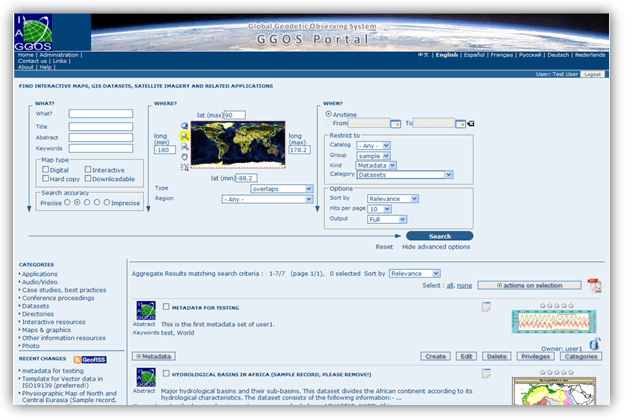
    The first prototype of the GGOS portal (ggos-portal.org) was developed by BKG (Germany) using the GeoNetwork Software Package.

    GGOS-Portal Screenshot – IAG Travaux Report 2007-2011

    Presentation “GGOS Portal and Meta Data” – Bernd Richter & Carey Noll – PDF File

  • 2012

    Stop of GGOS-Portal developments

    For personnel reasons, the development of the GGOS-Portal at BKG was discontinued.

  • 2020

  • 2022

    Revival of the GGOS Portal

    After finishing the development of the new GGOS website ggos.org the GGOS Coordinating Office started to revive the idea of the GGOS-Portal to make geodetic observation data and products more easily discoverable and accessible through attractively illustrated metadata.

    Presentation “GGOS-Portal – Revival of a Metadata Platform” – Martin Sehnal – GGOS Days 2022 – PDF File DOI: 10.5281/zenodo.7321835

  • 2023

    Community Survey

    Starting a community survey to inquired the opinions of geodetic data users and providers.

    Presentation “GGOS-Portal – General Idea and Community Survey Results” – Martin Sehnal – GGOS Days 2023 – PDF File

  • 2023

    Feasability Study

    A feasability study was done in collaboration of the BEV and the TU Wien.

    Steiner, L. (2023). Feasibility study for the development of a metadata web portal for geodetic data of the Global Geodetic Observing System. DOI

    Presentation “GGOS-Portal – Feasability Study and Perspectives” – Lena Steiner – GGOS Days 2023 – PDF File

References

DateKindTitleAuthorLink – DOI
2024-04PosterGGOS Portal – The future Metadata Platform for Geodetic Data – Feasibility Study and PerspectivesSehnal, M., & Steiner, L.DOI: 10.5194/egusphere-egu24-1314

Poster – PDF

2023-11Bachelor ThesisFeasibility study for the development of a metadata web portal for geodetic data of the Global Geodetic Observing SystemSteiner, L. DOI: 10.5281/zenodo.10255995
2023-11TableProducts and Metadata of IAG Services – OverviewSteiner, L., Sehnal, M., & Böhm, J.DOI: 10.48436/qr8re-ezj54
2023-09PresentationGGOS Portal – General Idea and Community Survey Results.Sehnal, M., Angermann, D., Elger, K., & Steiner, L. DOI: 10.5281/zenodo.8414112
2023-09PresentationGGOS Portal – Feasibility Study and PerspectivesSteiner, L., & Sehnal, M.DOI: 10.5281/zenodo.8414250
2023-07ReportGGOS Portal – Survey ResultsSehnal, M., & Steiner, L.DOI: 10.5281/zenodo.8113241