• Link to LinkedIn
  • Link to Youtube
  • Link to Facebook
  • Link to Instagram
  • Link to X
  • Link to Telegram
  • Link to Behance
  • Link to Rss this site
  • Link to Mail
  • NEWS
  • EVENTS
  • JOBS
  • MEMBER
  • Sitemap
    • Home
      • NEWS
      • EVENTS
      • JOBS
      • MEMBERSHIP
    • ⭐ About Geodesy
    • 🏛️ IAG | International Association of Geodesy
      • About IAG
      • Structure
      • 🎓 ECS – Early Career Scientists
      • 🌈 IDEA – Inclusion, Diversity, Equity, Accessibility
    •   └─ Comissions
      • 1️⃣ Reference Frames
      • 2️⃣ Gravity Field
      • 3️⃣ Earth Rotation & Geodynamics
      • 4️⃣ Positioning & Applications
    •   └─ Inter Commission Committees
      • 📚 ICCT – Theory
      • 🌊 ICCM – Marine Research
      • 🌥️ ICCC – Climate Research
    •   └─ Project QuGe
    •   └─ Services
    • 🌍 GGOS | Global Geodetic Observing System
      • About GGOS
      • Structure
      • 🛰️ Observations
      • 📦 Products
      • ⚙️ Services
  • Shopping Cart Shopping Cart
    0Shopping Cart
geodesy.science - IAG website
  • News
    • Home
      • NEWS
      • EVENTS
      • JOBS
      • MEMBERSHIP
    • ⭐ About Geodesy
    • 🏛️ IAG | International Association of Geodesy
      • About IAG
      • Structure
      • 🎓 ECS – Early Career Scientists
      • 🌈 IDEA – Inclusion, Diversity, Equity, Accessibility
    •   └─ Comissions
      • 1️⃣ Reference Frames
      • 2️⃣ Gravity Field
      • 3️⃣ Earth Rotation & Geodynamics
      • 4️⃣ Positioning & Applications
    •   └─ Inter Commission Committees
      • 📚 ICCT – Theory
      • 🌊 ICCM – Marine Research
      • 🌥️ ICCC – Climate Research
    •   └─ Project QuGe
    •   └─ Services
    • 🌍 GGOS | Global Geodetic Observing System
      • About GGOS
      • Structure
      • 🛰️ Observations
      • 📦 Products
      • ⚙️ Services
  • News
    • ALL News
    • 📰 General News
    • 🌍 Geodesy News
    • 📅 Event Update
    • 🏛️ Organisation News
  • Mailing List
  • IAG Newsletter
  • Social Media
  • Post Your News
  • Click to open the search input field Click to open the search input field Search
You are here: Home1 / Services

IERS | Relaunch of the Website www.iers.org

IERS, 🏛️ Organisation News
We are pleased to announce that, as of November 10, the IERS website has been relaunched and is now available in its updated form at www.iers.org. The main focus of this update was the modernization of the layout. The structure and the overall navigation have not changed significantly, ensuring that information may still be accessed in the familiar manner. In the course of the relaunch, we also took the opportunity to review and, where appropriate, update the content. We invite you to explore the new website and welcome any feedback or suggestions you may have.
November 18, 2025
https://geodesy.science/wp-content/uploads/iers-website-relaunch-2025-1.png 884 1062 admin https://geodesy.science/wp-content/uploads/IAG-logo-web.png admin2025-11-18 14:58:102025-11-18 14:58:10IERS | Relaunch of the Website www.iers.org

TIGER Symposium in Geodesy 2026 | Save the date: Sept. 28 – Oct. 1

Com3, IAG, IERS, IGETS, IGFS, 📅 Event Update
We will be hosting the TIGER Symposium in Geodesy 2026 in Gävle, Sweden. The symposium is organized by the International Association of Geodesy (IAG) Commission 3 and will bring together scientists working on Earth rotation, geodynamics, crustal…
October 23, 2025
https://geodesy.science/wp-content/uploads/tiger_logo-vs2_w-text-horizontal_Copyright-RebekkaSteffen_2025-10-22_d02976-scaled.png 997 2560 admin https://geodesy.science/wp-content/uploads/IAG-logo-web.png admin2025-10-23 06:23:512025-10-23 06:23:51TIGER Symposium in Geodesy 2026 | Save the date: Sept. 28 – Oct. 1

IGS Workshop 2026

IGS, 📅 Event Update
The International GNSS Service Workshop 2026 will be held 1–5 June 2026 at the Intercontinental Santiago, Chile. The workshop will gather global experts in GNSS and geodesy to share insights, showcase innovations, and shape the future of geodetic infrastructure.
September 11, 2025
https://geodesy.science/wp-content/uploads/Banner-scaled_Copyright-IGS_2025-05-26.jpg 559 2048 admin https://geodesy.science/wp-content/uploads/IAG-logo-web.png admin2025-09-11 08:05:262025-10-01 13:40:38IGS Workshop 2026
Doris Days School 2025

IDS DORIS School | DORIS Days 2025

IDS, 📅 Event Update
The IDS organizes new “DORIS Days” for early-career researchers and students, featuring online sessions on 3 November and a hybrid workshop on 5 November in Athens. Topics include the DORIS system, IDS applications, and hands-on data processing with Jupyter Notebook.
September 10, 2025
https://geodesy.science/wp-content/uploads/logo_DD_2025_Copyright-IDS_2025-09-08.png 1640 2048 admin https://geodesy.science/wp-content/uploads/IAG-logo-web.png admin2025-09-10 10:00:102025-09-09 09:57:12IDS DORIS School | DORIS Days 2025

16th SIRGAS School: “VLBI and SLR Data Processing”

Com1, ILRS, IVS, 📅 Event Update
The 16th SIRGAS School (San Juan, Argentina | Oct 27–Nov 1, 2025) will train professionals in VLBI and SLR data processing, strengthening geodetic capacities in Latin America through theory and practice at the Félix Aguilar Astronomical Observatory. Join us.
September 9, 2025
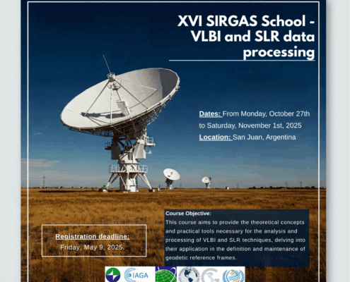
https://geodesy.science/wp-content/uploads/INGLES-1-1536x1536_Copyright-SIRGAS_2025-09-08.png 1536 1536 admin https://geodesy.science/wp-content/uploads/IAG-logo-web.png admin2025-09-09 07:28:522025-09-09 07:29:4616th SIRGAS School: “VLBI and SLR Data Processing”

Satellite Laser Ranging – How SLR Powers Geodesy

Com1, Com4, ECS, GGOS, IAG, ILRS, 🌍 Geodesy News
Discover Satellite Laser Ranging (SLR) – lasers from ground stations measure satellite and Moon positions with millimeter precision. SLR supports the Terrestrial Reference Frame, tracks Earth rotation, tectonic motion, improves gravity and sea level models, and tests relativity. Explore the science behind these precision measurements in our Geodesy Cartoon.
August 26, 2025
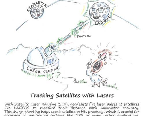
https://geodesy.science/wp-content/uploads/GeodesyCartoon_SLRstation_EN_v1-scaled.jpg 2048 1845 admin https://geodesy.science/wp-content/uploads/IAG-logo-web.png admin2025-08-26 10:44:152025-08-20 11:00:06Satellite Laser Ranging – How SLR Powers Geodesy
vlbi göteborg sweden

IVTW2025 – 10th International VLBI Technology Workshop

IVS, 📅 Event Update
This VLBI Workshop will be held October 21–25, 2025, at Chalmers University of Technology, Gothenburg, Sweden. It gathers global experts to discuss VLBI advancements, including station systems, recording, correlation, imaging, and space VLBI. Participants can visit Onsala Space Observatory and receiver clean rooms. Abstract submission closes September 1.
August 20, 2025
https://geodesy.science/wp-content/uploads/vlbi_workshop_ivtw_oso_langsmal_foto_r_hammargren_2020_300dpi_full-1.png 972 1924 admin https://geodesy.science/wp-content/uploads/IAG-logo-web.png admin2025-08-20 14:32:122025-08-20 14:30:56IVTW2025 – 10th International VLBI Technology Workshop

GGOS Days 2025 – Invitation

GGOS, Services, 📅 Event Update
Join us for GGOS Days 2025, held 1–5 September in Rimini, Italy, alongside the IAG2025 Scientific Assembly. Discover the latest GGOS achievements and challenges, connect with the community, and access contributions later in the GGOS Cloud.
August 19, 2025
https://geodesy.science/wp-content/uploads/IAG_SA2025_Rimini_GGOS.png 394 716 admin https://geodesy.science/wp-content/uploads/IAG-logo-web.png admin2025-08-19 10:37:392025-09-16 14:59:54GGOS Days 2025 – Invitation
Geodesy Cartoon

Lost Without Geodesy

Com4, ECS, GGOS, IAG, IGS, 🌍 Geodesy News
What happens if geodesy disappears? Phones, planes, and warning systems would fail. Our cartoon “Lost Without Geodesy” shows how vital this invisible science is. Geodesy powers GNSS, enabling precise positioning, earthquake monitoring, sea level studies, and more. Without it, GNSS would drift and global systems would collapse.
July 21, 2025
https://geodesy.science/wp-content/uploads/GeodesyCartoon_LostWithoutGeodesy_EN_v1.1-scaled.jpg 2048 1937 Martin Sehnal https://geodesy.science/wp-content/uploads/IAG-logo-web.png Martin Sehnal2025-07-21 09:00:202025-07-21 11:30:32Lost Without Geodesy
Geodesy Cartoon

First Geodesy Cartoon Released

Com1, Com2, ECS, GGOS, IAG, IGFS, 🌍 Geodesy News
We’re excited to share the first release in our new cartoon series about geodesy: The New Height of Qomolangma (Mt. Everest). This cartoon offers an engaging and educational look at the long-standing debate between China and Nepal over the…
June 12, 2025
https://geodesy.science/wp-content/uploads/HeightMtEverest_GeodesyCartoon_EN_v2-conflicted-copy-2025-04-10-151229.jpg 1813 2048 admin https://geodesy.science/wp-content/uploads/IAG-logo-web.png admin2025-06-12 11:12:102025-06-12 11:12:10First Geodesy Cartoon Released
Page 2 of 41234
📰 NEWS

└─ 📰 General News

└─ 🌍 Geodesy News

└─ 🏛️ Organisation News

└─ 📅 Event Update

📢 Latest News

  • Honorary colloquium for Prof. Torge and Prof. Seeber at Leibniz University Hannover
  • Webinar: A Synergy between EUREF and EPOS: GNSS Data Quality Monitoring Service (DQMS)
  • Geodesy Day – International Webinar on Geodesy
  • Geodetic Data: Applying FAIR, TRUST and CARE Principles
  • Geodesy Cartoons – Free Resources for Education and Outreach

✉️ Get Updates Regularly

Mailing List Subscription

Select the list(s) you'd like updates from:

No spam! Unsubscribe anytime. By signing up, you agree to our terms.

Thank you for subscribing! Please check your inbox or spam folder to confirm.

IAG as part of the IUGG

  
The International Association of Geodesy (IAG)  is a constituent association of the International Union of Geodesy and Geophysics (IUGG).

IAG Related Organisations

IAG collaborates closely with numerous organizations within geodesy and beyond. See the list for details.

Sitemap

  • Home | geodesy.science
  • ⠀└─ 📰News
  • ⠀└─ 📅 Events
  • ⠀└─ 💼 Jobs
  • ⠀└─ 👥 Membership
  • ⭐ About Geodesy
  • 🏛️ IAG | Int. Association of Geodesy
  • ⠀└─ ➡️ Commissions:
  • ⠀⠀◻️ 1 – Reference Frames
  • ⠀⠀◻️ 2 – Gravity Field
  • ⠀⠀◻️ 3 – Earth Rotation & Geodynamics
  • ⠀⠀◻️ 4 – Positioning and Applications
  • ⠀└─ 🔀 Inter Commission Committees:
  • ⠀⠀◻️ ICCT – Theory
  • ⠀⠀◻️ ICCM – Marine Research
  • ⠀⠀◻️ ICCC – Climate Research
  • ⠀└─ ⏰ Project QuGe
  • ⠀└─ ⚙️ IAG Services
  •  🌎 GGOS | Observing System
  • ⠀└─ About GGOS
  • ⠀└─ Structure
  • ⠀└─ Observations
  • ⠀└─ Products
  • ⠀└─ Services

References

Geodesy Glossary

Media Library

IAG Cloud | Public Documents

Terms of Use / Privacy Policy

IAG Statutes

IAG By-laws

Contact Us

Contact

Follow Us

LinkedIn

BlueSky

X (Twitter)

Facebook

Instagram

YouTube

Telegram

RSS Feed

Mailing List

This website is provided by the IAG Secretariat and the GGOS Coordinating Office, which are hosted by the BEV – Federal Office of Metrology and Surveying (Bundesamt für Eich- und Vermessungswesen) in Vienna, Austria.

Website Language Translation

The primary language of this website is English – however, the integrated GTranslate tool enables automatic translation into several languages:

Please note that translations into other languages may not be accurate. For reliable information, refer to the English version of the website.

2026 © Copyright | IAG - International Association of Geodesy
  • Link to LinkedIn
  • Link to Youtube
  • Link to Facebook
  • Link to Instagram
  • Link to X
  • Link to Telegram
  • Link to Behance
  • Link to Rss this site
  • Link to Mail
Scroll to top Scroll to top Scroll to top
Accessibility Adjustments

Powered by OneTap

How long do you want to hide the toolbar?
Hide Toolbar Duration
Select your accessibility profile
Vision Impaired Mode
Enhances website's visuals
Seizure Safe Profile
Clear flashes & reduces color
ADHD Friendly Mode
Focused browsing, distraction-free
Blindness Mode
Reduces distractions, improves focus
Epilepsy Safe Mode
Dims colors and stops blinking
Content Modules
Font Size

Default

Line Height

Default

Color Modules
Orientation Modules