First Geodesy Cartoon Released
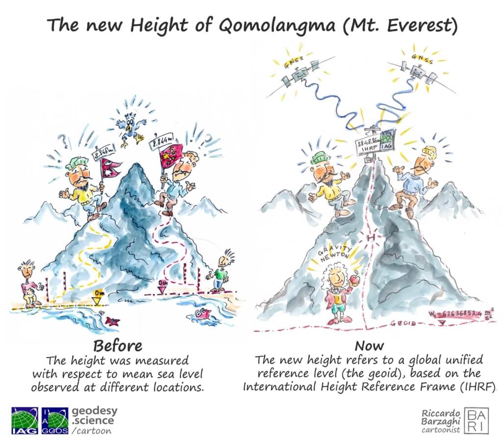
We’re excited to share the first release in our new cartoon series about geodesy: The New Height of Qomolangma (Mt. Everest). This cartoon offers an engaging and educational look at the long-standing debate between China and Nepal over the official height of Mt. Everest. Each country reported slightly different values based on their national height reference systems. Only through international cooperation and a shared global standard — the International Height Reference Frame (IHRF) — was it possible to reach a unified solution.
Why do height measurements differ between countries?
→ Learn more about height systems
What is a Height Reference Frame, and why is a global standard essential?
→ Explore the concept of the IHRF
Why does the IHRF Coordination Center matter?
→ Find out here
About the Series
This cartoon is part of a broader effort to raise awareness of geodesy through visual storytelling. To make this essential science more accessible, the International Association of Geodesy (IAG) and its Global Geodetic Observing System (GGOS) have launched a new multilingual cartoon series. The goal: to highlight geodesy’s critical role in understanding our planet.
→ Watch the Geodesy Cartoon website
More episodes are coming soon — stay tuned!
Author: Martin Sehnal (Director of GGOS CO)

