GNSS-A
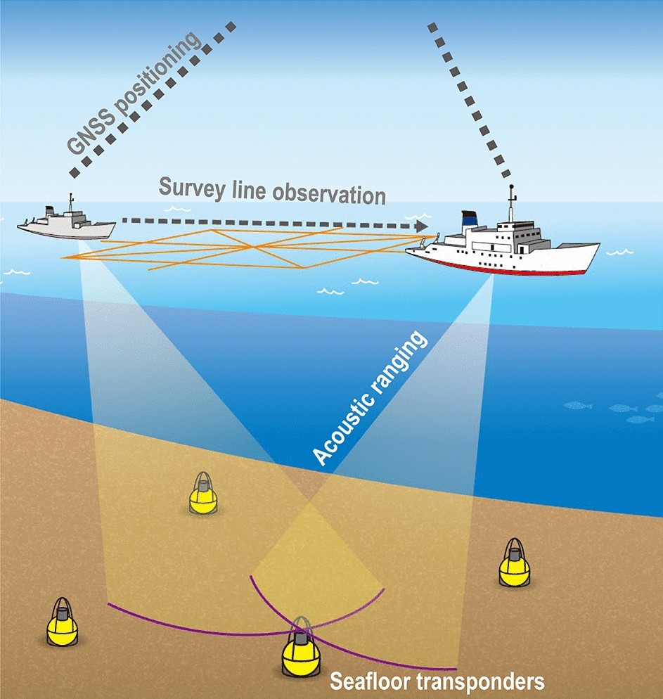
The GNSS–Acoustic ranging combination method (GNSS-A) is a technique for the underwater global positioning, typically used to detect seafloor crustal deformation with an accuracy of better than one centimeter per year. By using a surface platform equipped with a GNSS antenna/receiver and an acoustic transducer, the acoustically derived position of the underwater station is linked to the GNSS reference frame.