 https://geodesy.science/wp-content/uploads/Hobart12_Copyright-DavidSchunckUTAS_2026-02-24_78c49e.JPG
1080
1920
admin
https://geodesy.science/wp-content/uploads/IAG-logo-web.png
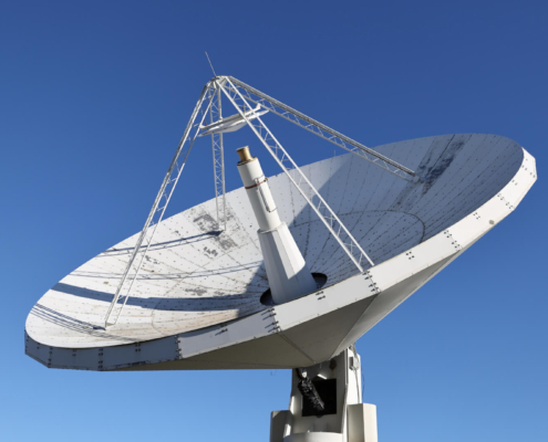
admin2026-02-24 12:34:222026-02-24 14:08:28New Website: Discover the Importance of VLBI for Geodesy and Society
https://geodesy.science/wp-content/uploads/Hobart12_Copyright-DavidSchunckUTAS_2026-02-24_78c49e.JPG
1080
1920
admin
https://geodesy.science/wp-content/uploads/IAG-logo-web.png
admin2026-02-24 12:34:222026-02-24 14:08:28New Website: Discover the Importance of VLBI for Geodesy and Society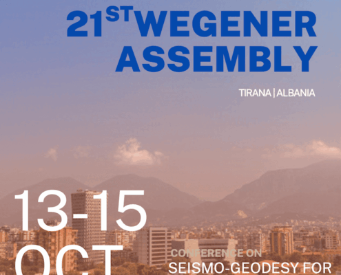 https://geodesy.science/wp-content/uploads/flyer_wegener_01_Copyright-KristinaMatrakuIGEO_2026-01-12_3f3ce5.png
1131
800
admin
https://geodesy.science/wp-content/uploads/IAG-logo-web.png
admin2026-01-13 06:33:492026-01-13 06:33:4921st WEGENER ASSEMBLY – Tirana, Albania, October 13–15, 2026
https://geodesy.science/wp-content/uploads/flyer_wegener_01_Copyright-KristinaMatrakuIGEO_2026-01-12_3f3ce5.png
1131
800
admin
https://geodesy.science/wp-content/uploads/IAG-logo-web.png
admin2026-01-13 06:33:492026-01-13 06:33:4921st WEGENER ASSEMBLY – Tirana, Albania, October 13–15, 2026
 https://geodesy.science/wp-content/uploads/REFAG_UAW_HP1-scaled.png
778
2048
admin
https://geodesy.science/wp-content/uploads/IAG-logo-web.png
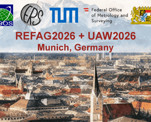
admin2025-12-12 07:18:202025-12-12 07:40:36REFAG2026: Early bird registration deadline – 15 December 2025
https://geodesy.science/wp-content/uploads/REFAG_UAW_HP1-scaled.png
778
2048
admin
https://geodesy.science/wp-content/uploads/IAG-logo-web.png
admin2025-12-12 07:18:202025-12-12 07:40:36REFAG2026: Early bird registration deadline – 15 December 2025 https://geodesy.science/wp-content/uploads/eventNews1_AdobeStock_238163501.jpeg
1004
1504
admin
https://geodesy.science/wp-content/uploads/IAG-logo-web.png
admin2025-11-24 06:10:222025-11-24 07:20:12Canadian Geophysical Union 2026 Scientific Meeting – Call for Abstracts
https://geodesy.science/wp-content/uploads/eventNews1_AdobeStock_238163501.jpeg
1004
1504
admin
https://geodesy.science/wp-content/uploads/IAG-logo-web.png
admin2025-11-24 06:10:222025-11-24 07:20:12Canadian Geophysical Union 2026 Scientific Meeting – Call for Abstracts https://geodesy.science/wp-content/uploads/AdobeStock_254781413.jpeg
1120
1680
Martin Sehnal
https://geodesy.science/wp-content/uploads/IAG-logo-web.png
Martin Sehnal2025-11-20 11:02:342025-11-20 11:12:09New IAG Publications | Geodesist’s Handbook 2024 & IAG Travaux 2023–2025
https://geodesy.science/wp-content/uploads/AdobeStock_254781413.jpeg
1120
1680
Martin Sehnal
https://geodesy.science/wp-content/uploads/IAG-logo-web.png
Martin Sehnal2025-11-20 11:02:342025-11-20 11:12:09New IAG Publications | Geodesist’s Handbook 2024 & IAG Travaux 2023–2025
 https://geodesy.science/wp-content/uploads/IAG_Awardees_2025__1__Copyright-IAG_2025-09-12.png
376
359
admin
https://geodesy.science/wp-content/uploads/IAG-logo-web.png
admin2025-09-12 07:46:532025-09-12 07:46:53IAG Honors Outstanding Contributions in Geodesy: Awardees of 2023 and 2024
https://geodesy.science/wp-content/uploads/IAG_Awardees_2025__1__Copyright-IAG_2025-09-12.png
376
359
admin
https://geodesy.science/wp-content/uploads/IAG-logo-web.png
admin2025-09-12 07:46:532025-09-12 07:46:53IAG Honors Outstanding Contributions in Geodesy: Awardees of 2023 and 2024
