 https://geodesy.science/wp-content/uploads/Flyer_Geodesy_summer_school_compressed_Copyright-Belongtotheschool_2026-02-27_be4f02-scaled.jpg
2560
1810
admin
https://geodesy.science/wp-content/uploads/IAG-logo-web.png
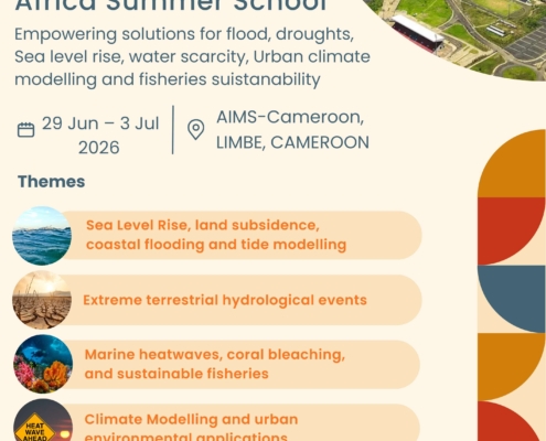
admin2026-03-02 13:09:262026-03-03 08:25:53Geodesy for a Resilient Africa Summer School (2026)
https://geodesy.science/wp-content/uploads/Flyer_Geodesy_summer_school_compressed_Copyright-Belongtotheschool_2026-02-27_be4f02-scaled.jpg
2560
1810
admin
https://geodesy.science/wp-content/uploads/IAG-logo-web.png
admin2026-03-02 13:09:262026-03-03 08:25:53Geodesy for a Resilient Africa Summer School (2026)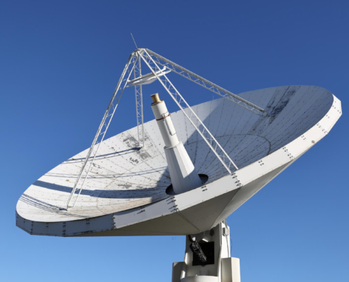 https://geodesy.science/wp-content/uploads/Hobart12_Copyright-DavidSchunckUTAS_2026-02-24_78c49e.JPG
1080
1920
admin
https://geodesy.science/wp-content/uploads/IAG-logo-web.png
admin2026-02-24 12:34:222026-02-24 14:08:28New Website: Discover the Importance of VLBI for Geodesy and Society
https://geodesy.science/wp-content/uploads/Hobart12_Copyright-DavidSchunckUTAS_2026-02-24_78c49e.JPG
1080
1920
admin
https://geodesy.science/wp-content/uploads/IAG-logo-web.png
admin2026-02-24 12:34:222026-02-24 14:08:28New Website: Discover the Importance of VLBI for Geodesy and Society


 https://geodesy.science/wp-content/uploads/ECSNet-video-1.jpg
670
1191
Helmut Klima
https://geodesy.science/wp-content/uploads/IAG-logo-web.png
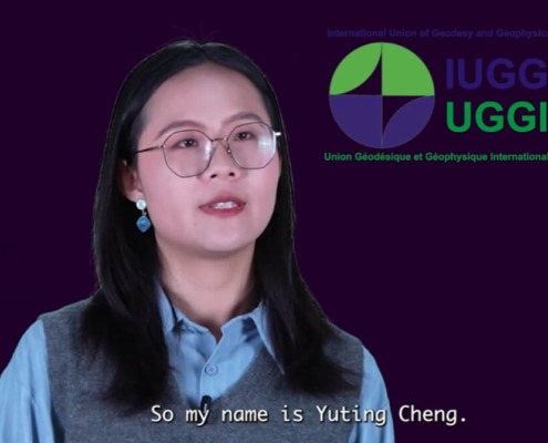
Helmut Klima2025-12-05 09:58:122025-11-27 10:21:31Spotlight on Young Researchers – ECSNet Video Series
https://geodesy.science/wp-content/uploads/ECSNet-video-1.jpg
670
1191
Helmut Klima
https://geodesy.science/wp-content/uploads/IAG-logo-web.png
Helmut Klima2025-12-05 09:58:122025-11-27 10:21:31Spotlight on Young Researchers – ECSNet Video Series https://geodesy.science/wp-content/uploads/ecs_AdobeStock_3647304651.jpeg
653
2208
admin
https://geodesy.science/wp-content/uploads/IAG-logo-web.png
admin2025-11-24 06:12:532025-11-24 07:27:33Open Call for Early Career Researchers – EPOS-GNSS TCS Participation in EPOS Days 2026
https://geodesy.science/wp-content/uploads/ecs_AdobeStock_3647304651.jpeg
653
2208
admin
https://geodesy.science/wp-content/uploads/IAG-logo-web.png
admin2025-11-24 06:12:532025-11-24 07:27:33Open Call for Early Career Researchers – EPOS-GNSS TCS Participation in EPOS Days 2026 https://geodesy.science/wp-content/uploads/AdobeStock_254781413.jpeg
1120
1680
Martin Sehnal
https://geodesy.science/wp-content/uploads/IAG-logo-web.png
Martin Sehnal2025-11-20 11:02:342025-11-20 11:12:09New IAG Publications | Geodesist’s Handbook 2024 & IAG Travaux 2023–2025
https://geodesy.science/wp-content/uploads/AdobeStock_254781413.jpeg
1120
1680
Martin Sehnal
https://geodesy.science/wp-content/uploads/IAG-logo-web.png
Martin Sehnal2025-11-20 11:02:342025-11-20 11:12:09New IAG Publications | Geodesist’s Handbook 2024 & IAG Travaux 2023–2025
