Geoid
The geoid is an equipotential surface of the Earth’s gravity field that closely approximates mean sea level, that is, the average surface of the oceans in the absence of dynamic influences such as winds, tides, currents, and atmospheric pressure variations. It represents the surface to which water would settle if the oceans were allowed to adjust only under the influence of gravity and Earth’s rotation. Because the geoid follows variations in the Earth’s gravity field caused by uneven mass distribution within the planet, it has an irregular shape that differs from a simple geometric ellipsoid.
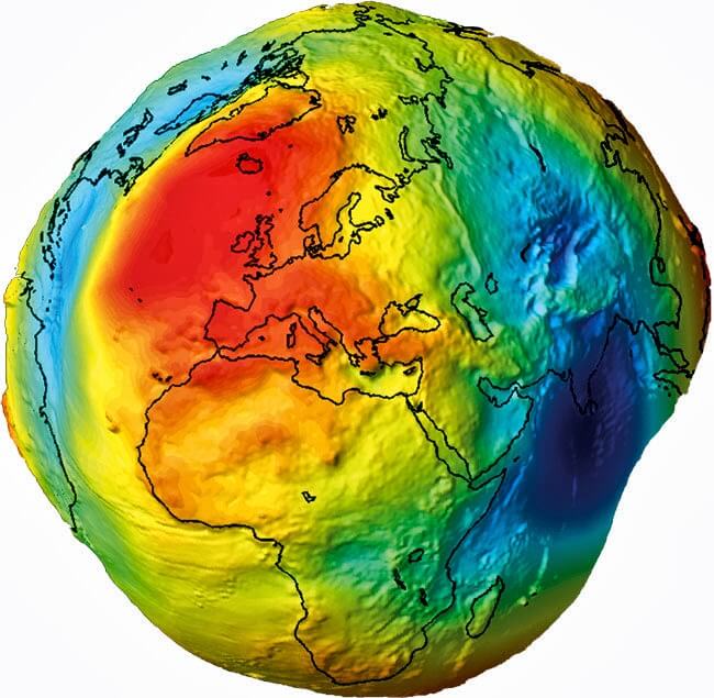 In geodesy, the geoid plays a fundamental role as the reference surface for the definition of physical heights. Heights measured in surveying and engineering are typically related to the geoid rather than to a purely geometric surface. Accurate knowledge of the geoid is therefore essential for establishing consistent height reference systems, such as the International Height Reference System, and for applications ranging from mapping and infrastructure development to oceanography, hydrology, and the study of mass transport and sea level change within the Earth system.
More Info:

