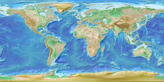
DEM – Digital Elevation Models
Digital Elevation Models (DEMs) represent the topographic surface of the Earth, either as terrain (DTM) or surface (DSM). They are generated from satellite, LiDAR, or photogrammetric data. DEMs are fundamental for geospatial analysis, hydrology, and geodetic applications. They are widely used for terrain analysis, flood and watershed modeling, infrastructure planning, and many other Earth science and engineering applications.
More Info: