 © ROB (http://gnss.be)
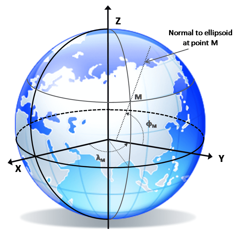
WGS84 – World Geodetic System 1984
WGS84 is a global reference coordinate system used notably by GPS. It defines Earth’s shape (reference ellipsoid), origin, orientation, and a time-dependent reference frame for positioning and navigation applications worldwide. The accuracy of WGS84 depends on its realization: early versions provided about 1–2 m absolute accuracy, while newer realizations (such as G2139) are closely aligned with ITRF2020 and can achieve sub-decimetre to centimetre consistency with the International Terrestrial Reference Frame under favourable conditions.
The International Terrestrial Reference Frame (ITRF) itself represents the most accurate realization of the global terrestrial reference system currently available. It is derived from the combination of multiple space geodetic techniques—including GNSS, VLBI, SLR, and DORIS, and provides highly precise station coordinates and velocities at the millimetre level. Because of this accuracy and long-term stability, the ITRF serves as the fundamental reference for global geodesy and for aligning other systems such as WGS84.
More Info:

