 https://geodesy.science/wp-content/uploads/Hobart12_Copyright-DavidSchunckUTAS_2026-02-24_78c49e.JPG
1080
1920
admin
https://geodesy.science/wp-content/uploads/IAG-logo-web.png
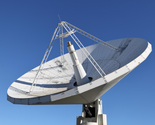
admin2026-02-24 12:34:222026-02-24 14:08:28New Website: Discover the Importance of VLBI for Geodesy and Society
https://geodesy.science/wp-content/uploads/Hobart12_Copyright-DavidSchunckUTAS_2026-02-24_78c49e.JPG
1080
1920
admin
https://geodesy.science/wp-content/uploads/IAG-logo-web.png
admin2026-02-24 12:34:222026-02-24 14:08:28New Website: Discover the Importance of VLBI for Geodesy and Society
 https://geodesy.science/wp-content/uploads/GeodesyCartoon_SLRstation_EN_v1-scaled.jpg
2048
1845
admin
https://geodesy.science/wp-content/uploads/IAG-logo-web.png
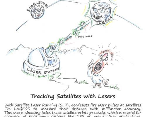
admin2025-08-26 10:44:152025-08-20 11:00:06Satellite Laser Ranging – How SLR Powers Geodesy
https://geodesy.science/wp-content/uploads/GeodesyCartoon_SLRstation_EN_v1-scaled.jpg
2048
1845
admin
https://geodesy.science/wp-content/uploads/IAG-logo-web.png
admin2025-08-26 10:44:152025-08-20 11:00:06Satellite Laser Ranging – How SLR Powers Geodesy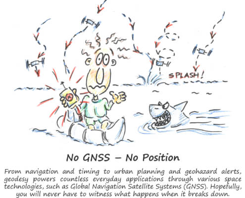 https://geodesy.science/wp-content/uploads/GeodesyCartoon_LostWithoutGeodesy_EN_v1.1-scaled.jpg
2048
1937
Martin Sehnal
https://geodesy.science/wp-content/uploads/IAG-logo-web.png
Martin Sehnal2025-07-21 09:00:202025-07-21 11:30:32Lost Without Geodesy
https://geodesy.science/wp-content/uploads/GeodesyCartoon_LostWithoutGeodesy_EN_v1.1-scaled.jpg
2048
1937
Martin Sehnal
https://geodesy.science/wp-content/uploads/IAG-logo-web.png
Martin Sehnal2025-07-21 09:00:202025-07-21 11:30:32Lost Without Geodesy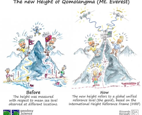 https://geodesy.science/wp-content/uploads/HeightMtEverest_GeodesyCartoon_EN_v2-conflicted-copy-2025-04-10-151229.jpg
1813
2048
admin
https://geodesy.science/wp-content/uploads/IAG-logo-web.png
admin2025-06-12 11:12:102025-06-12 11:12:10First Geodesy Cartoon Released
https://geodesy.science/wp-content/uploads/HeightMtEverest_GeodesyCartoon_EN_v2-conflicted-copy-2025-04-10-151229.jpg
1813
2048
admin
https://geodesy.science/wp-content/uploads/IAG-logo-web.png
admin2025-06-12 11:12:102025-06-12 11:12:10First Geodesy Cartoon Released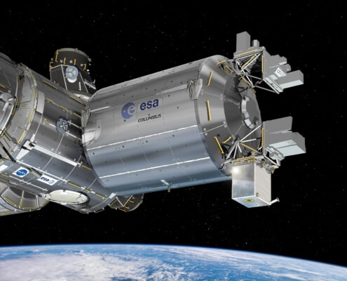 https://geodesy.science/wp-content/uploads/ESA_ACES_on_Columbus.jpg
1375
1750
Martin Sehnal
https://geodesy.science/wp-content/uploads/IAG-logo-web.png
Martin Sehnal2025-05-28 05:53:282025-06-18 12:03:20A new atomic clock in space could help us measure elevations on Earth
https://geodesy.science/wp-content/uploads/ESA_ACES_on_Columbus.jpg
1375
1750
Martin Sehnal
https://geodesy.science/wp-content/uploads/IAG-logo-web.png
Martin Sehnal2025-05-28 05:53:282025-06-18 12:03:20A new atomic clock in space could help us measure elevations on Earth https://geodesy.science/wp-content/uploads/society-AdobeStock_2761418611-scaled.jpeg
1870
2048
Martin Sehnal
https://geodesy.science/wp-content/uploads/IAG-logo-web.png
Martin Sehnal2025-04-10 05:42:132025-05-26 11:08:19New Paper Highlights the Power of Geodesy to Support Science and Society
https://geodesy.science/wp-content/uploads/society-AdobeStock_2761418611-scaled.jpeg
1870
2048
Martin Sehnal
https://geodesy.science/wp-content/uploads/IAG-logo-web.png
Martin Sehnal2025-04-10 05:42:132025-05-26 11:08:19New Paper Highlights the Power of Geodesy to Support Science and Society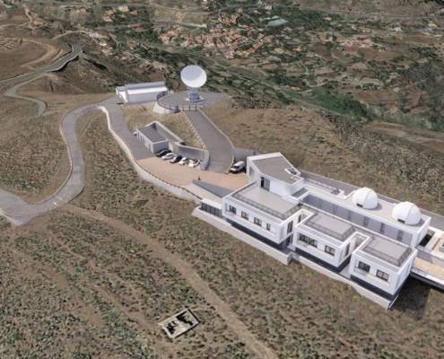 https://geodesy.science/wp-content/uploads/RAEGE_Temisas-1.jpg
872
1417
Martin Sehnal
https://geodesy.science/wp-content/uploads/IAG-logo-web.png
Martin Sehnal2025-03-14 05:57:472025-10-06 12:36:33New RAEGE Station in Gran Canaria: A Milestone for Global Geodesy
https://geodesy.science/wp-content/uploads/RAEGE_Temisas-1.jpg
872
1417
Martin Sehnal
https://geodesy.science/wp-content/uploads/IAG-logo-web.png
Martin Sehnal2025-03-14 05:57:472025-10-06 12:36:33New RAEGE Station in Gran Canaria: A Milestone for Global Geodesy https://geodesy.science/wp-content/uploads/EN_TRFshort_squareBackground.png
1497
1497
Martin Sehnal
https://geodesy.science/wp-content/uploads/IAG-logo-web.png
Martin Sehnal2024-06-19 07:00:082025-03-04 10:04:11New Video: Discover the Importance of Terrestrial Reference Frames
https://geodesy.science/wp-content/uploads/EN_TRFshort_squareBackground.png
1497
1497
Martin Sehnal
https://geodesy.science/wp-content/uploads/IAG-logo-web.png
Martin Sehnal2024-06-19 07:00:082025-03-04 10:04:11New Video: Discover the Importance of Terrestrial Reference Frames © Pexels
https://geodesy.science/wp-content/uploads/photography-of-barrel-wave-1298684-Kopie-scaled-1.jpg
1440
2560
Martin Sehnal
https://geodesy.science/wp-content/uploads/IAG-logo-web.png
Martin Sehnal2024-05-02 13:40:142025-10-01 13:01:12GGOS as basis for GeoRisk Commission (GRC) and the IUGG contributions to disaster risk reduction
© Pexels
https://geodesy.science/wp-content/uploads/photography-of-barrel-wave-1298684-Kopie-scaled-1.jpg
1440
2560
Martin Sehnal
https://geodesy.science/wp-content/uploads/IAG-logo-web.png
Martin Sehnal2024-05-02 13:40:142025-10-01 13:01:12GGOS as basis for GeoRisk Commission (GRC) and the IUGG contributions to disaster risk reduction
