
• Link to LinkedIn
  • Link to Youtube
  • Link to Facebook
  • Link to Instagram
  • Link to X
  • Link to Telegram
  • Link to Behance
  • Link to Rss this site
  • Link to Mail
  • NEWS
  • EVENTS
  • JOBS
  • MEMBER
  • Sitemap
    • Home
      • NEWS
      • EVENTS
      • JOBS
      • MEMBERSHIP
    • ⭐ About Geodesy
    • 🏛️ IAG | International Association of Geodesy
      • About IAG
      • Structure
      • 🎓 ECS – Early Career Scientists
      • 🌈 IDEA – Inclusion, Diversity, Equity, Accessibility
    •   └─ Comissions
      • 1️⃣ Reference Frames
      • 2️⃣ Gravity Field
      • 3️⃣ Earth Rotation & Geodynamics
      • 4️⃣ Positioning & Applications
    •   └─ Inter Commission Committees
      • 📚 ICCT – Theory
      • 🌊 ICCM – Marine Research
      • 🌥️ ICCC – Climate Research
    •   └─ Project QuGe
    •   └─ Services
    • 🌍 GGOS | Global Geodetic Observing System
      • About GGOS
      • Structure
      • 🛰️ Observations
      • 📦 Products
      • ⚙️ Services
  • Shopping Cart Shopping Cart
    0Shopping Cart
geodesy.science - IAG website
  • GGOS
    • Home
      • NEWS
      • EVENTS
      • JOBS
      • MEMBERSHIP
    • ⭐ About Geodesy
    • 🏛️ IAG | International Association of Geodesy
      • About IAG
      • Structure
      • 🎓 ECS – Early Career Scientists
      • 🌈 IDEA – Inclusion, Diversity, Equity, Accessibility
    •   └─ Comissions
      • 1️⃣ Reference Frames
      • 2️⃣ Gravity Field
      • 3️⃣ Earth Rotation & Geodynamics
      • 4️⃣ Positioning & Applications
    •   └─ Inter Commission Committees
      • 📚 ICCT – Theory
      • 🌊 ICCM – Marine Research
      • 🌥️ ICCC – Climate Research
    •   └─ Project QuGe
    •   └─ Services
    • 🌍 GGOS | Global Geodetic Observing System
      • About GGOS
      • Structure
      • 🛰️ Observations
      • 📦 Products
      • ⚙️ Services
  • About
    • About GGOS
      • What is GGOS?
      • Why GGOS?
      • Dual Roles of GGOS
      • Vision and Mission
      • GGOS History
  • Structure
    • Governance & Leadership
      • Governing Board GB
      • Executive Committee EC
    • Coordinating Office CO
    • Science Panel
    • Bureaus
      • BNO – Networks and Observations
      • BPS – Products and Standards
    • Focus Areas
      • Geohazards Monitoring
      • Geodetic Space Weather Research
      • Artificial Intelligence for Geodesy (AI4G)
    • GGOS Affiliates
      • GGOS Japan
      • GGOS D-A-CH
      • GGOS IberAtlantic
    • GGOS Committees & Working Groups
  • Observations
  • Services
  • Products
  • Resources
    • Resources Overview
    • Outreach Materials
    • Logos & Organisation Chart
    • Reports and Articles
    • Presentations and Videos
    • GGOS Meeting Reports
    • Terms of Reference and Strategy
  • Click to open the search input field Click to open the search input field Search
You are here: Home1 / IAG GGOS2 / GGOS Observations3 / IERS – Int. Earth Rotation and Reference Systems Service

IERS – Int. Earth Rotation and Reference Systems Service

IERS iag service earth rotation reference system frame
Go To Service

Development

The IERS was established as the International Earth Rotation Service in 1987 by the International Astronomical Union and the International Union of Geodesy and Geophysics, and it began operation on 1 January 1988. Since 2001, the IERS works in a new organizational structure; in 2003, the new name of the Service, without changing its abbreviation, was adopted. The IERS is a member of the International Committee on Global Navigation Satellite Systems (ICG) and of the World Data System (WDS).

see also: http://www.iers.org/IERS/EN/Organization/About/History/history.html

Objectives

The primary objectives of the IERS are to serve the astronomical, geodetic and geophysical communities by providing the following:

  • The International Celestial Reference System (ICRS) and its realization, the International Celestial Reference Frame (ICRF)
  • The International Terrestrial Reference System (ITRS) and its realization, the International Terrestrial Reference Frame (ITRF)
  • Earth orientation parameters required to study earth orientation variations and to transform between the ICRF and the ITRF
  • Geophysical data to interpret time/space variations in the ICRF, ITRF or earth orientation parameters, and model such variations
  • Standards, constants and models (i.e., conventions) encouraging international adherence

Products

IERS collects, archives and distributes products to satisfy the objectives of a wide range of applications, research and experimentation. These products include the following:

  • International Celestial Reference Frame
  • International Terrestrial Reference Frame
  • Long-term earth orientation information
  • Monthly earth orientation data
  • Daily rapid service estimates of near real-time earth orientation data and their predictions
  • Announcements of the differences between astronomical and civil time for time distribution by radio stations
  • Leap second announcements
  • Products related to global geophysical fluids such as mass and angular momentum distribution
  • Annual report and technical notes on conventions and other topics
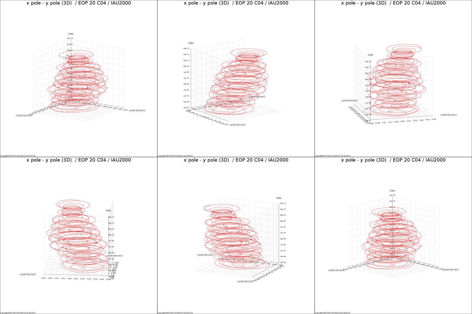
IERS pole offset

Polar motion, 1962 to 2023, from IERS EOP series 14 C04 (IAU2000A). The latest version of this figure is available at https://datacenter.iers.org/data/gif/EOPC04_20_62-NOW-X_Y.gif.

The accuracies of these products are sufficient to support current scientific and technical objectives including the following:

  • Fundamental astronomical and geodetic reference systems
  • Monitoring and modelling earth rotation/orientation
  • Monitoring and modelling deformations of the solid earth
  • Monitoring mass variations in the geophysical fluids, including the atmosphere and the hydrosphere
  • Artificial satellite orbit determination
  • Geophysical and atmospheric research, studies of dynamical interactions between geophysical fluids and the solid earth
  • Space navigation.

see also: http://www.iers.org/IERS/EN/DataProducts/data.html

Structure

The IERS accomplishes its mission through the following components:

  • Technique Centers: International DORIS Service, International GNSS Service, International Laser Ranging Service, and International VLBI Service
  • Product Centers: Earth Orientation Center, Rapid Service/Prediction Center, Conventions Center, ICRS Center, ITRS Center, and Global Geophysical Fluids Center with Special Bureaus for the Atmosphere, for the Oceans, for Hydrology, and for Combination
  • ITRS Combination Centers at Deutsches Geodätisches Forschungsinstitut (DGFI), Institut Géographique National (IGN), and Jet Propulsion Laboratory (JPL)
  • Analysis Coordinator
  • Central Bureau
  • Directing Board
  • Working Groups: WG on Site Survey and Co-location, WG on SINEX Format, IAG/IAU/IERS Joint WG on the Consistent Realization of TRF, CRF, and EOP, and WG on the 2nd Earth Orientation Parameter Prediction Comparison Campaign.

Some of these components (e.g., Technique Centers) may be autonomous operations, structurally independent from IERS, but which cooperate with the IERS. A participating organization may also function as one or several of these components (except as a Directing Board).

see also: http://www.iers.org/IERS/EN/Organization/organization.html

IERS Directing Board

visit the IERS homepage for a list of current members

Content of this contribution provided by Wolfgang Dick and Bernd Richter.

IAG SERVICES

Geometric & General Services

  • IERS iag service earth rotation reference system frame© IERS
    IERS – Int. Earth Rotation and Reference Systems Service
  • IGS iag service gnss global navigation satellite system© IGS
    IGS – International GNSS Service
  • ILRS laser ranging service iag© ILRS
    ILRS – International Laser Ranging Service
  • IVS VLBI Service IAG© IVS
    IVS – International VLBI Service for Geodesy and Astrometry
  • IDS iag service DORIS© IDS
    IDS – International Doris Service
  • PSMSL Permanent Service for Mean Sea Level IAG© PSMSL
    PSMSL – Permanent Service for Mean Sea Level

Gravity Services

  • IGFS iag service gravity field© IGFS
    IGFS – International Gravity Field Service
  • ICGEM iag service© ICGEM
    ICGEM – International Centre for Global Earth Models
  • IDEMS iag service DEM digital elevation model© IDEMS
    IDEMS – International Digital Elevation Model Service
  • IGETS iag service© IGETS
    IGETS – International Geodynamics and Earth Tide Service
  • ISG service geoid IAG© ISG
    ISG – International Service for the Geoid
  • BGI gravimetric service IAG© BGI
    BGI – International Gravimetric Bureau

IAG as part of the IUGG

  
The International Association of Geodesy (IAG)  is a constituent association of the International Union of Geodesy and Geophysics (IUGG).

IAG Related Organisations

IAG collaborates closely with numerous organizations within geodesy and beyond. See the list for details.

Sitemap

  • Home | geodesy.science
  • ⠀└─ 📰News
  • ⠀└─ 📅 Events
  • ⠀└─ 💼 Jobs
  • ⠀└─ 👥 Membership
  • ⭐ About Geodesy
  • 🏛️ IAG | Int. Association of Geodesy
  • ⠀└─ ➡️ Commissions:
  • ⠀⠀◻️ 1 – Reference Frames
  • ⠀⠀◻️ 2 – Gravity Field
  • ⠀⠀◻️ 3 – Earth Rotation & Geodynamics
  • ⠀⠀◻️ 4 – Positioning and Applications
  • ⠀└─ 🔀 Inter Commission Committees:
  • ⠀⠀◻️ ICCT – Theory
  • ⠀⠀◻️ ICCM – Marine Research
  • ⠀⠀◻️ ICCC – Climate Research
  • ⠀└─ ⏰ Project QuGe
  • ⠀└─ ⚙️ IAG Services
  •  🌎 GGOS | Observing System
  • ⠀└─ About GGOS
  • ⠀└─ Structure
  • ⠀└─ Observations
  • ⠀└─ Products
  • ⠀└─ Services

References

Geodesy Glossary

Media Library

IAG Cloud | Public Documents

Terms of Use / Privacy Policy

IAG Statutes

IAG By-laws

Contact Us

Contact

Follow Us

LinkedIn

BlueSky

X (Twitter)

Facebook

Instagram

YouTube

Telegram

RSS Feed

Mailing List

This website is provided by the IAG Secretariat and the GGOS Coordinating Office, which are hosted by the BEV – Federal Office of Metrology and Surveying (Bundesamt für Eich- und Vermessungswesen) in Vienna, Austria.

Website Language Translation

The primary language of this website is English – however, the integrated GTranslate tool enables automatic translation into several languages:

Please note that translations into other languages may not be accurate. For reliable information, refer to the English version of the website.

2026 © Copyright | IAG - International Association of Geodesy
  • Link to LinkedIn
  • Link to Youtube
  • Link to Facebook
  • Link to Instagram
  • Link to X
  • Link to Telegram
  • Link to Behance
  • Link to Rss this site
  • Link to Mail
Scroll to top Scroll to top Scroll to top
Accessibility Adjustments

Powered by OneTap

How long do you want to hide the toolbar?
Hide Toolbar Duration
Select your accessibility profile
Vision Impaired Mode
Enhances website's visuals
Seizure Safe Profile
Clear flashes & reduces color
ADHD Friendly Mode
Focused browsing, distraction-free
Blindness Mode
Reduces distractions, improves focus
Epilepsy Safe Mode
Dims colors and stops blinking
Content Modules
Font Size

Default

Line Height

Default

Color Modules
Orientation Modules

