Relative Mean Sea Level and its Change
Relative Mean Sea Level (RMSL)
RMSL is the long-term average height of the ocean surface relative to the adjacent land at a specific coastal location. It is determined primarily from tide gauge observations (and, more recently, using GNSS reflectometry) and therefore reflects the combined effects of changes in sea level and vertical land motion. Because tide gauges are fixed to the Earth’s crust, RMSL represents the height of the sea surface with respect to a local tide gauge benchmark and is typically expressed in a local vertical datum.
Relative Sea Level Change (RSLC)
is inferred from the temporal variations in Relative Mean Sea Level (RMSL) derived from long-term tide gauge records. To infer sea level changes with high reliability, the vertical land motion needs to be removed from the tide gauge records. In the analysis of historical tide gauge data, only effects of the Glacial Isostatic Adjustment (GIA) are considered. In analysis based on recent data, the vertical land motion at tide gauge locations is determined with GNSS positioning. Although the GNSS-based vertical land motions represent short time intervals (5 to 20 years only), it is usually assumed that they represent long-term trends. Different studies based on historical or reconstructed tide gauge data agreed on a mean rate 20th century sea level rise in the range of 1.6 to 1.8 mm/yr.

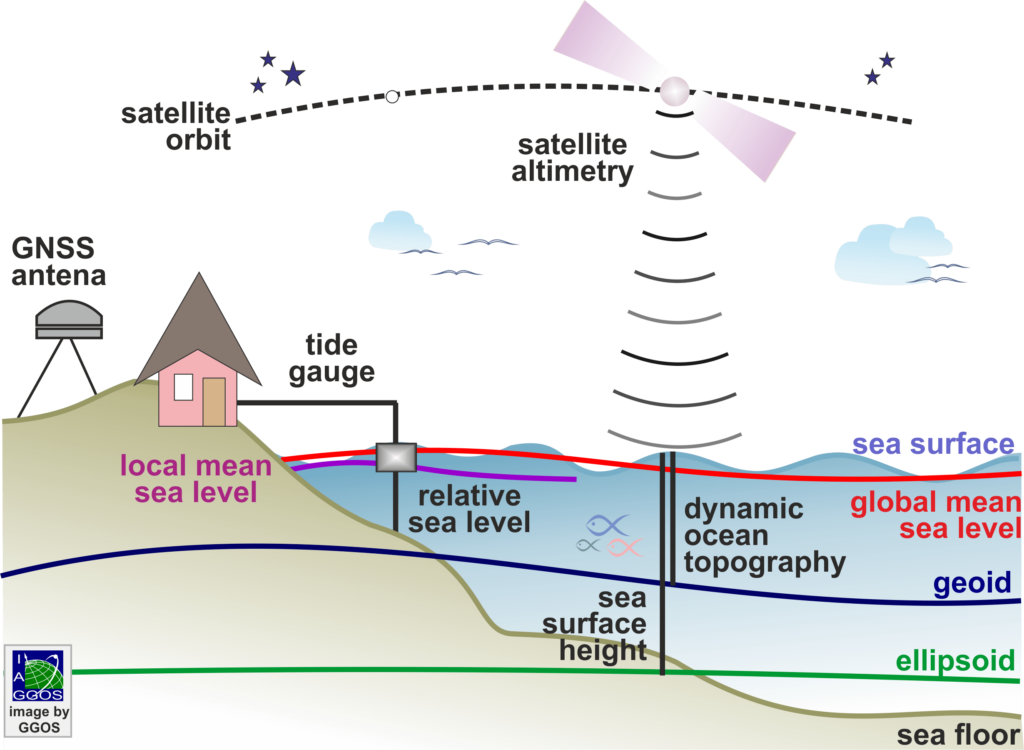
Monitoring sea level with tide gauges and satellite altimetry (Image by L. Sánchez)
Historical tide gauge measurements are of fundamental importance because they provide the longest direct observational records of sea level. This makes them the primary source of empirical data for reconstructing historical sea level changes prior to the era of satellite altimetry.
Data Sources