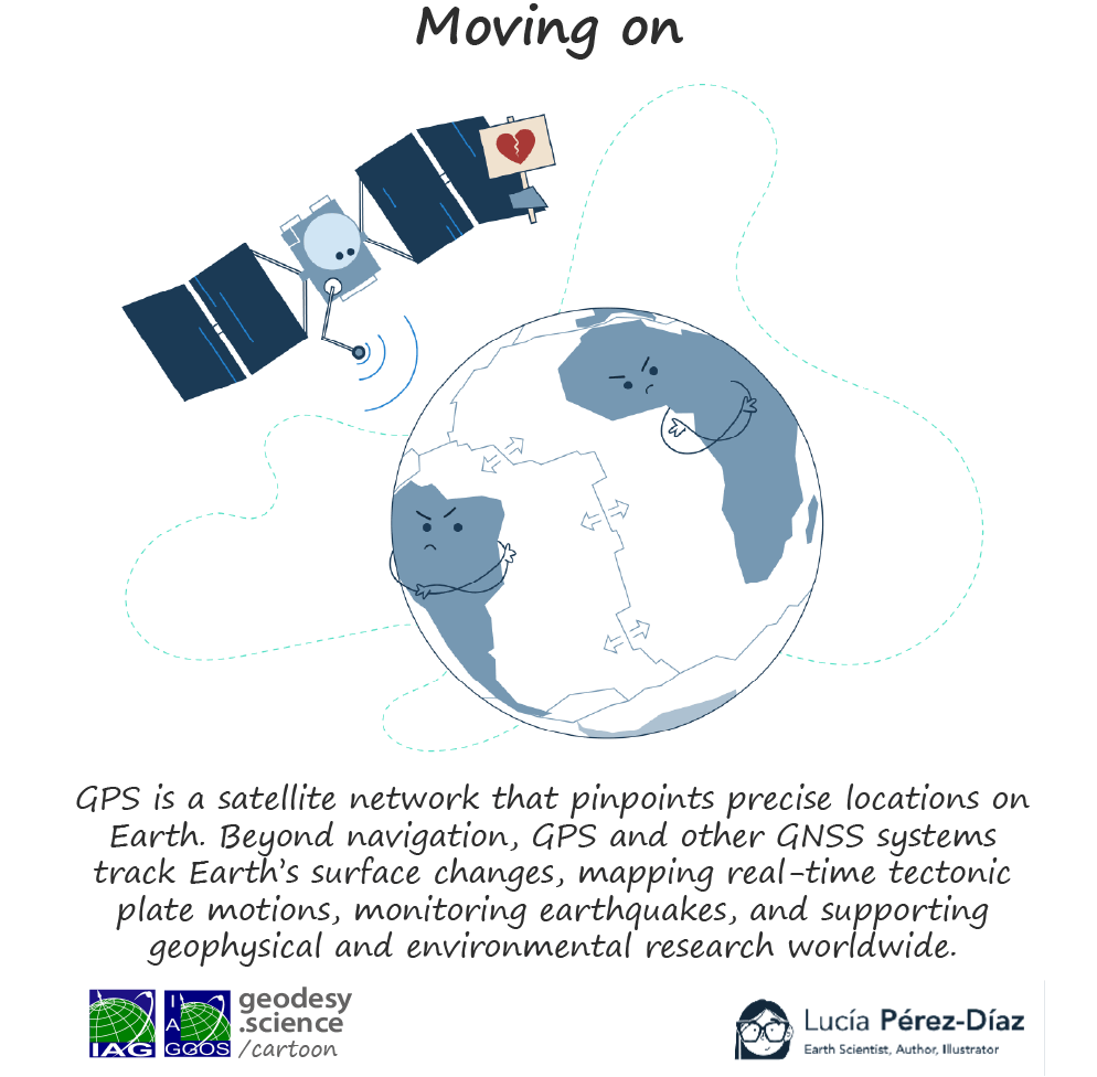
Earth’s Surface Deformation (ESD)
Why is the Earth’s surface in constant change?
Ongoing geodynamic processes can be inferred from crustal deformation detected through repeated or continuous geodetic observations. The fundamental approach is to determine the geometry of a geodetic network at successive observation epochs and compare the resulting network configurations. Changes in the network geometry over time, typically spanning years to decades, are interpreted as deformation caused by the underlying geodynamic processes affecting the study area. Network deformation is generally analysed by separating the horizontal and vertical components, allowing the identification and quantification of different deformation patterns.
To ensure high reliability in the determination of the network geometry, the geodetic measurements must be processed over the entire time span following strict standards and procedures. The existing geodetic space techniques allow the determination of station positions and velocities with accuracies at the millimetre and the sub-millimetre/year level, respectively.
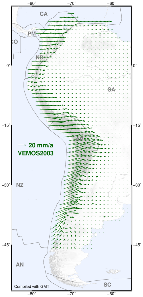

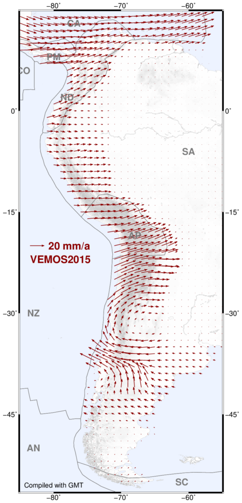
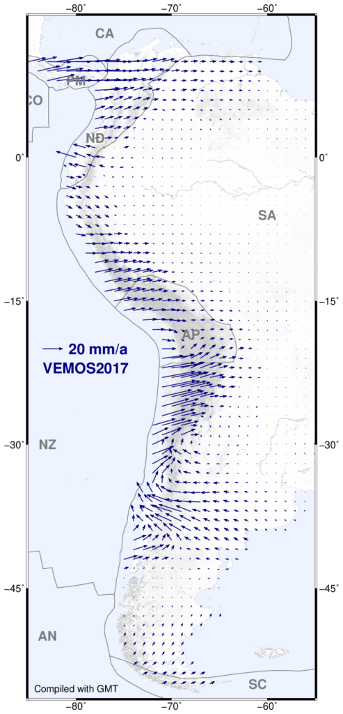
The station velocities in a geodetic network mirror a superposition of a large-scale variation (common to all stations) and a short-scale variation (specific for each station). The large-scale variation usually represents the motion of the tectonic plate underlying the area covered by the geodetic network, while the short-scale variation represents the deviation of the station motions from the plate motion; i.e., a deformation. A surface deformation model is then inferred by interpolating the pointwise short-scale variations to a regular grid. Presently, surface deformations are mainly determined using Global Navigation Satellite Systems (GNSS) positioning and Interferometric Synthetic Aperture Radar (InSAR) techniques.
Surface deformation models play a main role in geodesy. Geodetic reference frames comprise coordinates of station positions at a certain epoch and constant velocities describing a secular station motion. In active seismic regions, strong earthquakes cause large displacements of station positions and velocity changes disabling the use of such coordinates over any time periods. With the surface deformation models, it is possible to monitor the kinematics of reference frames, to determine transformation parameters between pre-seismic and post-seismic (deformed) coordinates, and to interpolate surface motions arising from plate tectonics or crustal deformations in areas where no geodetic stations are established.
Vertical deformation represents the uplift or subsidence of the Earth’s crust resulting from tectonic, volcanic, glacial isostatic, hydrological, or anthropogenic processes. It is primarily determined from continuous or repeated GNSS observations and InSAR measurements, which together provide complementary information on the magnitude and spatial distribution of vertical land motion. Vertical deformation is a key factor in regional sea-level change, as land uplift or subsidence can amplify or offset climate-driven sea-level rise and, in many vulnerable coastal regions, may equal or even exceed the magnitude of changes in the sea surface itself.
Data Sources
Surface deformation models for geodetic applications are specially needed in regions with strong seismic activity. They are usually provided by the national geodetic agencies. Organisations responsible for the regional densification of the ITRF (International Terrestrial Reference Frame) also provide some regional surface deformation models.
Global and regional data are also provided by
European Ground Motion Service (EGMS): Part of the Copernicus Land Monitoring Service, providing millimeter-accurate natural and anthropogenic ground motion data using Sentinel-1 radar satellite interferometry across Europe.
SONEL: Operating under the Global Sea Level Observing System (GLOSS) and hosted in France, it serves as a dedicated global assembly center linking continuous GNSS data to coastal tide gauges to measure vertical land movements. It also contributes to the Working group Tide Gauge Benchmark Monitoring (TIGA) of the International GNSS Service (IGS).
Nevada Geodetic Laboratory (NGL): Processes multi-year global GPS/GNSS position time series and vertical velocity fields used extensively by researchers worldwide to calculate tectonic and anthropogenic land motion.