
Interferometric Synthetic Aperture Radar
InSAR
What is InSAR?
Interferometric Synthetic Aperture Radar (InSAR) is an Earth observation technique that uses repeated radar observations acquired by satellites to map topography and measure changes in the Earth’s surface over time. Since InSAR is an imaging technique, it creates dense spatial measurements with high detail over areas ranging from individual infrastructure sites to entire continents. By comparing radar images acquired over the same area at different times, InSAR can detect millimetre to centimetre-scale surface motion (ground deformation) and generate detailed digital elevation models. Unlike optical imaging systems, radar sensors operate day and night and can acquire observations through cloud cover, providing a reliable means of monitoring the dynamic Earth system.
How does InSAR work?
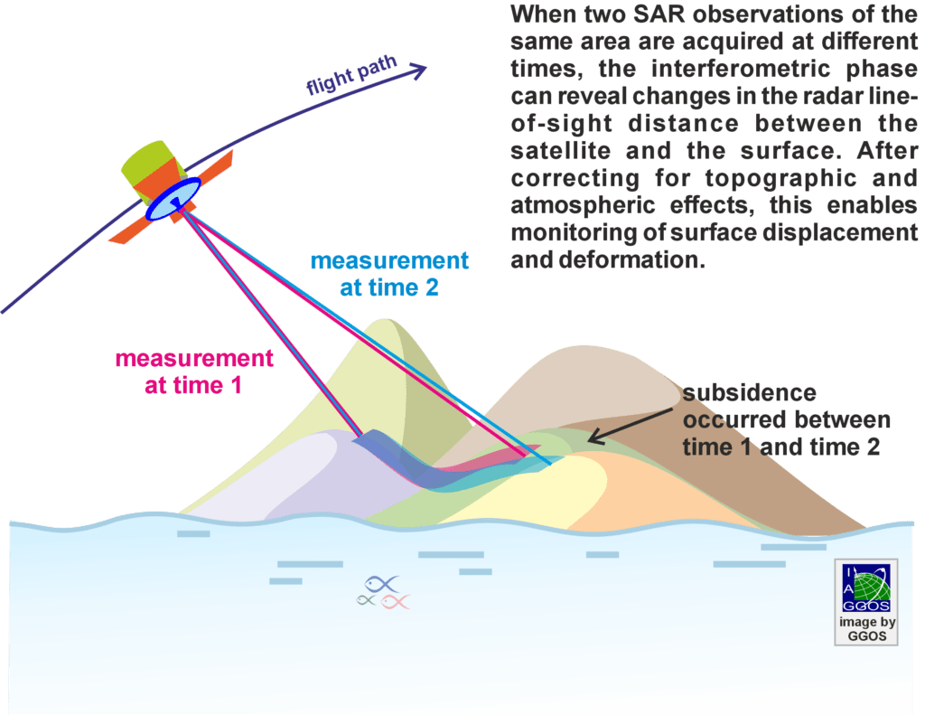
Radar instruments onboard satellites transmit microwave signals toward the Earth’s surface and record the reflected echoes. By comparing the phase of repeated radar acquisitions taken from nearly identical orbital positions, InSAR measures tiny changes-often just millimetres-in the distance between the satellite and the ground, measured along the satellite’s line of sight.
Importance for Geodesy
Within Global Geodetic Observing System, InSAR contributes a unique capability by providing dense spatial observations that complement the discrete point-based measurements delivered by terrestrial and space-geodetic techniques, such as Global Navigation Satellite Systems (GNSS). Together, these techniques contribute to monitoring Earth’s shape, deformation and dynamic processes while supporting realization and maintenance of terrestrial reference frames.
InSAR also relies on and benefits from dedicated ground-based geodetic infrastructure, including continuously operating GNSS stations, precisely surveyed reference points and radar calibration targets (such as corner reflectors and transponders), which support calibration, validation, quality assurance, geolocation accuracy and integration with terrestrial reference frames.
Unlike traditional geodetic techniques that provide highly accurate measurements at discrete locations, InSAR delivers millions of measurements over large areas, making it uniquely suited for mapping spatially continuous surface deformation.

Applications
InSAR is widely used to:
- Measure crustal deformation associated with earthquakes, tectonic processes and volcanic activity.
- Monitor land subsidence related to groundwater extraction, mining and urban development.
- Generate digital elevation models and map topography.
- Support natural hazard monitoring, including landslides and ground instability.
- Support infrastructure monitoring, including buildings, bridges, railways, dams and other engineered structures.
- Contribute to long-term observations of environmental and climate-related change.



