• Link to LinkedIn
  • Link to Youtube
  • Link to Facebook
  • Link to Instagram
  • Link to X
  • Link to Telegram
  • Link to Behance
  • Link to Rss this site
  • Link to Mail
  • NEWS
  • EVENTS
  • JOBS
  • MEMBER
  • Sitemap
    • Home
      • NEWS
      • EVENTS
      • JOBS
      • MEMBERSHIP
    • ⭐ About Geodesy
    • 🏛️ IAG | International Association of Geodesy
      • About IAG
      • Structure
      • 🎓 ECS – Early Career Scientists
      • 🌈 IDEA – Inclusion, Diversity, Equity, Accessibility
    •   └─ Comissions
      • 1️⃣ Reference Frames
      • 2️⃣ Gravity Field
      • 3️⃣ Earth Rotation & Geodynamics
      • 4️⃣ Positioning & Applications
    •   └─ Inter Commission Committees
      • 📚 ICCT – Theory
      • 🌊 ICCM – Marine Research
      • 🌥️ ICCC – Climate Research
    •   └─ Project QuGe
    •   └─ Services
    • 🌍 GGOS | Global Geodetic Observing System
      • About GGOS
      • Structure
      • 🛰️ Observations
      • 📦 Products
      • ⚙️ Services
  • Shopping Cart Shopping Cart
    0Shopping Cart
geodesy.science - IAG website
  • GGOS
    • Home
      • NEWS
      • EVENTS
      • JOBS
      • MEMBERSHIP
    • ⭐ About Geodesy
    • 🏛️ IAG | International Association of Geodesy
      • About IAG
      • Structure
      • 🎓 ECS – Early Career Scientists
      • 🌈 IDEA – Inclusion, Diversity, Equity, Accessibility
    •   └─ Comissions
      • 1️⃣ Reference Frames
      • 2️⃣ Gravity Field
      • 3️⃣ Earth Rotation & Geodynamics
      • 4️⃣ Positioning & Applications
    •   └─ Inter Commission Committees
      • 📚 ICCT – Theory
      • 🌊 ICCM – Marine Research
      • 🌥️ ICCC – Climate Research
    •   └─ Project QuGe
    •   └─ Services
    • 🌍 GGOS | Global Geodetic Observing System
      • About GGOS
      • Structure
      • 🛰️ Observations
      • 📦 Products
      • ⚙️ Services
  • About
    • About GGOS
      • What is GGOS?
      • Why GGOS?
      • Dual Roles of GGOS
      • Vision and Mission
      • GGOS History
  • Structure
    • Governance & Leadership
      • Governing Board GB
      • Executive Committee EC
    • Coordinating Office CO
    • Science Panel
    • Bureaus
      • BNO – Networks and Observations
      • BPS – Products and Standards
    • Focus Areas
      • Geohazards Monitoring
      • Geodetic Space Weather Research
      • Artificial Intelligence for Geodesy (AI4G)
    • GGOS Affiliates
      • GGOS Japan
      • GGOS D-A-CH
      • GGOS IberAtlantic
    • GGOS Committees & Working Groups
  • Observations
  • Services
  • Products
  • EGV
  • Resources
    • Resources Overview
    • Outreach Materials
    • Logos & Organisation Chart
    • Reports and Articles
    • Presentations and Videos
    • GGOS Meeting Reports
    • Terms of Reference and Strategy
  • Click to open the search input field Click to open the search input field Search
Follow a manual added link

Land, Marine and Absolute

Gravity Data

What is the purpose of measuring gravity on the Earth’s surface?

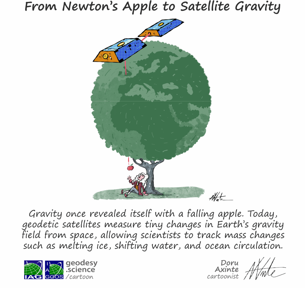
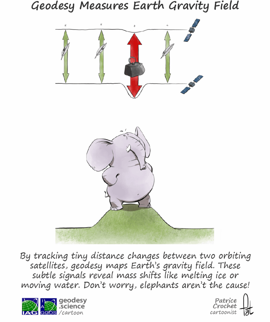
The collection, homogenization and validation of all available gravity measurements acquired at or close to the Earth’s surface (e.g. airborne measurements) and their distribution to scientific users is an important task to improve the global knowledge of the Earth’s gravity field. Before the era of the satellite gravity missions CHAMP, GRACE, GRACE Follow-on and GOCE, the computation of the gravity field models was based primarily on terrestrial gravity measurements together with Satellite Laser Ranging (SLR) data. But even today, these terrestrial gravity measurements play a fundamental role for the validation of the results derived from the satellite gravity missions, and these data are indispensable for the computation of high-resolution gravity field models.
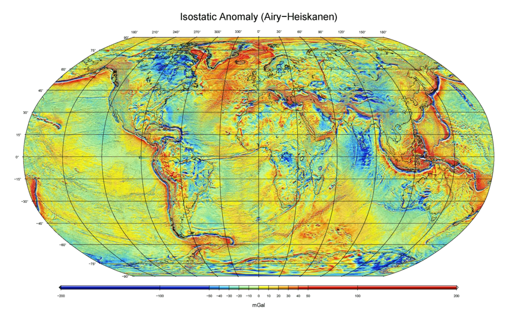

Ionostatic Anomaly Airy-Heiskanen mGal BGI Gravimetric Gravity
© S. Bonvalot, BGI Info Info

Isostatic anomaly derived from Airy-Heiskanen model for isostatic compensation

Follow a manual added link

Land Gravity Data

Land gravity data consists of gravity measurements obtained through land-based and airborne gravimetry. Land-based gravimetry involves measuring the local gravity field using instruments deployed on the Earth’s surface. These include relative gravimeters, absolute gravimeters and superconducting gravimeters. These observations are used to characterise subsurface mass distribution, detect temporal variations in terrestrial mass and contribute to establishing and maintaining high-precision geodetic reference networks. Airborne gravimetry measures the Earth’s gravity field from aircraft or helicopters, integrating gravimeter observations with GNSS positioning and inertial navigation systems. This technique enables regional variations in mass distribution and density to be mapped, supporting applications in geodesy, Earth sciences, and resource exploration. As measurements can be efficiently collected over extensive and difficult-to-access regions, airborne gravity surveys are an effective means of acquiring gravity data over large areas.
Follow a manual added link

Marine Gravity Data

Marine gravity data consists of gravity measurements derived from shipborne gravimetry. This technique involves observing the Earth’s gravity field from a moving vessel using specialised gravimeters, with corrections applied to account for the ship’s movement. These observations are crucial for mapping gravity variations in coastal and offshore areas, and are used in studies of the marine geophysical environment and in determining the oceanic gravity field.

Follow a manual added link

Absolute Gravity Data

Absolute gravity data: Gravity measurements can be classified as either absolute or relative, depending on the approach taken to make the measurement. Absolute gravimetry determines the actual value of gravitational acceleration at a specific location and time by directly measuring acceleration due to gravity. As length and time measurements are linked to traceable metrological standards, absolute gravimeters can directly determine the local gravity field (e.g. approximately 9.8xx xxx xx m/s²). State-of-the-art instruments can achieve an accuracy of around 1×10^(−8) m s^(−2), which corresponds to approximately one part per billion. In contrast, relative gravimetry measures gravity differences between two locations or temporal variations in gravity at a fixed site. Although they do not provide an absolute gravity value, relative gravimeters are highly sensitive and can detect changes in gravity with an accuracy comparable to that achieved by absolute instruments, reaching the parts-per-billion level. These measurements are widely used in land-, airborne- and shipborne-based gravimetry.

International Gravimetric Bureau

In 1951, the International Gravimetric Bureau (BGI) has been created as a scientific service of IAG (within the IGFS – International Gravity Field Service) for ensuring the collection, validation, archiving and distribution of the terrestrial gravity data to a large variety of users for scientific applications. The global databases of BGI include:

  • land gravity data
  • marine gravity data
  • airborne gravity data
  • absolute gravity data
  • gravity observations at gravity reference stations

BGI also contributes to the realization of derived gravity products to support studies of the Earth gravity field at global and regional scales. This includes high-resolution grids and maps of Earth´s gravity anomalies of different kind and gravity anomaly grids computed from standard high-resolution gravity field models (e.g. EGM2008). Other services include online tools for predicting gravity at a given site, tools and software for data acquisition or validation, the attribution of digital object identifier (DOI) for gravity data sets, and various documentations (e.g., BGI data formats, gravity anomalies, absolute gravity data base, tutorials). BGI has its Central Bureau in Toulouse, France and operates with the support of various French agencies and universities. BGI services benefit also from a close collaboration of other agencies from Germany (BKG), Italy (POLIMI), Greece (AUTH), Czech Republic (VUGTK), Denmark (DTU) and USA (NGA).

Data Sources

Global Gravity Databases

  • Land gravity measurements
  • Marine gravity measurements
  • Absolute gravity measurements (AGrav)
  • Reference gravity stations

    ISGN71 network

Global or Regional Products

  • Earth’s gravity anomalies

    Grids and models

Other Services

  • Toolbox
  • Documentations & Tutorials

    Documentation on BGI data formats, gravity anomalies, absolute gravity database and tutorials

© GGOS (Prepared by: D. Angermann, S. Bonvalot, R. Barzaghi, K. Heki, Y. Tanaka)

view all cartoons

PRODUCTS

Reference Frames

  • Height Reference Frame
  • Celestial Reference Frame
  • Gravity Reference Frame
  • Terrestrial Reference Frame

Earth Orientation

  • Earth Orientation Parameter Products

Geometry

  • Relative Sea Level & Change
  • Glaciers
  • Earth’s Surface Deformation
  • Global Sea Level
  • Global Sea Level Change
  • Digital Elevation & Terrain Model
  • Ice Sheets
  • Station Position Time Series
  • Sea Water Level Records
  • Mean Sea Surface

Gravity Field

  • Topographic Gravity Field Models
  • Regional Gravity Field Quantities
  • Global Gravity Field Quantities
  • Glaciers
  • Global Gravity Field Models
  • Time Series Gravity Data
  • Land, Marine and Absolute Gravity Data
  • Regional Geoid Models
  • Ice Sheets
  • Regional Height Reference Frame

Positioning & Applications

  • Thermosphere Products
  • Ionosphere Products
  • Troposphere Products
  • GNSS Satellite Orbits, Clocks and Biases

IAG as part of the IUGG

  
The International Association of Geodesy (IAG)  is a constituent association of the International Union of Geodesy and Geophysics (IUGG).

IAG Related Organisations

IAG collaborates closely with numerous organizations within geodesy and beyond. See the list for details.

Sitemap

  • Home | geodesy.science
  • ⠀└─ 📰News
  • ⠀└─ 📅 Events
  • ⠀└─ 💼 Jobs
  • ⠀└─ 👥 Membership
  • ⭐ About Geodesy
  • 🏛️ IAG | Int. Association of Geodesy
  • ⠀└─ ➡️ Commissions:
  • ⠀⠀◻️ 1 – Reference Frames
  • ⠀⠀◻️ 2 – Gravity Field
  • ⠀⠀◻️ 3 – Earth Rotation & Geodynamics
  • ⠀⠀◻️ 4 – Positioning and Applications
  • ⠀└─ 🔀 Inter Commission Committees:
  • ⠀⠀◻️ ICCT – Theory
  • ⠀⠀◻️ ICCM – Marine Research
  • ⠀⠀◻️ ICCC – Climate Research
  • ⠀└─ ⏰ Project QuGe
  • ⠀└─ ⚙️ IAG Services
  •  🌎 GGOS | Observing System
  • ⠀└─ About GGOS
  • ⠀└─ Structure
  • ⠀└─ Observations
  • ⠀└─ Products
  • ⠀└─ Services

References

Geodesy Glossary

Media Library

IAG Cloud | Public Documents

Terms of Use / Privacy Policy

IAG Statutes

IAG By-laws

Contact Us

Contact

Follow Us

LinkedIn

BlueSky

X (Twitter)

Facebook

Instagram

YouTube

Telegram

RSS Feed

Mailing List

This website is provided by the IAG Secretariat and the GGOS Coordinating Office, which are hosted by the BEV – Federal Office of Metrology and Surveying (Bundesamt für Eich- und Vermessungswesen) in Vienna, Austria.

Website Language Translation

The primary language of this website is English – however, the integrated GTranslate tool enables automatic translation into several languages:

Please note that translations into other languages may not be accurate. For reliable information, refer to the English version of the website.

2026 © Copyright | IAG - International Association of Geodesy
  • Link to LinkedIn
  • Link to Youtube
  • Link to Facebook
  • Link to Instagram
  • Link to X
  • Link to Telegram
  • Link to Behance
  • Link to Rss this site
  • Link to Mail
Scroll to top Scroll to top Scroll to top
Accessibility Adjustments

Powered by OneTap

How long do you want to hide the toolbar?
Hide Toolbar Duration
Select your accessibility profile
Vision Impaired Mode
Enhances website's visuals
Seizure Safe Profile
Clear flashes & reduces color
ADHD Friendly Mode
Focused browsing, distraction-free
Blindness Mode
Reduces distractions, improves focus
Epilepsy Safe Mode
Dims colors and stops blinking
Content Modules
Font Size

Default

Line Height

Default

Color Modules
Orientation Modules