Regional Gravity Field Quantities (RGFQ)
Regional gravity field models represent gravity field quantities at high spatial resolution. They are derived by combining satellite gravimetry with terrestrial, airborne, and marine gravity observations, thereby providing the highest possible spatial resolution of the Earth’s gravity field. Based on these models, point values or gridded representations of different gravity field functionals can be computed. While global gravity field quantities are derived from global gravity field models, providing coverage of the entire Earth, the regional gravity field quantities focus on specific regions or limited areas, allowing additional local observations to be incorporated, enabling a significantly higher spatial resolution than is achievable with global models alone.
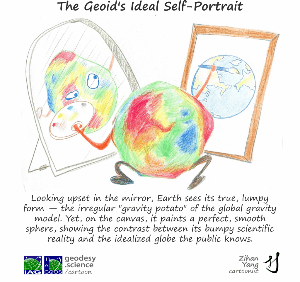
To precisely determine the variations in the Earth’s gravity, geodesists use a mathematical model of the Earth as a reference body. This model is called the reference ellipsoid and is a mathematical apparatus of the planet. The reference ellipsoid has the same size and flattening as the Earth, contains the same mass as the Earth and rotates at the same rate as the Earth. These four properties make it possible to infer the ellipsoid’s gravity field, commonly known as the normal gravity field. Unlike the real Earth, the mass distribution inside the ellipsoid is assumed to be homogeneous. Geodesists therefore focus on identifying the differences in gravity between the real Earth and the ellipsoid.
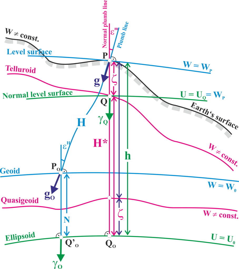
- Gravity (g) and gravitation (FG): Any object on Earth’s surface experiences a gravitational force due to the mass of the Earth and other celestial bodies, as well as a centrifugal force resulting from Earth’s rotation. The resultant of these two effects is the force of gravity. Gravitation refers to the attraction produced by mass according to Newton’s law of universal gravitation, excluding the centrifugal contribution. Gravity (g), in contrast, is the effective force (or acceleration) defined as the vector sum of gravitation and centrifugal force.
- Gravitational potential (V): The work per unit mass required by gravitational attraction to bring a unit mass from infinity (where gravitational potential vanishes) to the considered point. Equivalently, this is the Newtonian gravitational attraction, excluding centrifugal potential.
- Gravity potential (W): The potential of the gravity field of the Earth, being the sum of the gravitational (attraction) potential and the centrifugal potential due to the Earth’s rotation.
- Gravity disturbance (dg): The difference between the magnitude of the Earth’s actual gravity and the magnitude of the normal gravity at the same point.
- Gravity anomaly on the geoid (Dg): The difference between the magnitude of the Earth’s gravity at a point P₀ on the geoid (obtained by reducing observed surface gravity) and normal gravity at the point Q’₀ on the reference ellipsoid situated on the same ellipsoidal normal, Δg = g(P₀) − g(Q’₀). The two quantities thus refer to different points, in contrast to the gravity disturbance.
- Gravity anomaly on the Earth’s surface (Dg): The difference between the magnitude of the Earth’s actual gravity at a point P on the Earth’s surface and normal gravity at the corresponding point Q on the telluroid, located on the same ellipsoidal normal as P, Δg = g(P) − g(Q). The telluroid is the surface formed by the points Q at which the normal potential equals the actual potential at the corresponding surface points P, U(Q) = W(P).
- Disturbing potential (T): The difference between the Earth’s actual gravity potential and the normal gravgravity potential at the same point.
- Geoid undulation or geoid height (N): The distance, measured along the ellipsoidal normal, between the reference ellipsoid and the geoid (the equipotential surface of the Earth’s gravity field closely approximating mean sea level). It relates ellipsoidal (h) and orthometric (H) heights through h = H + N.
- Height anomaly (z): The distance, along the normal plumb line, between a point P on the Earth’s surface and the corresponding point Q on the telluroid. Equivalently, it is the separation between the reference ellipsoid and the quasigeoid. it relates ellipsoidal (h) and normal (H*) heights through h = H + z. Over the oceans the height anomaly practically coincides with the geoid undulation.
- Deflections of the vertical (e): The geometric angle between the direction of the plumb line (direction of the Earth’s actual gravity vector) and the direction of the normal plumb line (direction of the normal gravgravity vector, practically coinciding with the ellipsoidal normal). It is customarily decomposed into a north-south and an east-west component.
- Gravity gradient: The spatial rate of change of the gravity vector, mathematically the tensor of second derivatives of the gravity potential. It describes how gravity varies with position.
Within the International Gravity Field Service (IGFS) of the International Association of Geodesy (IAG), the International Gravimetric Bureau (BGI) and the International Service for the Geoid (ISG) provide data and regional gravity models. BGI ensures the collection, validation, archiving and distribution of terrestrial gravity data to a large variety of users for scientific applications. The global databases of BGI include:
- land gravity data
- marine gravity data
- airborne gravity data
- absolute gravity data
- gravity observations at gravity reference stationsInternational Centre for Global Earth
ISG manages and preserves an openly accessible repository, aiming at storing and redistributing geoid models in standardized data format, providing also ancillary information useful for the geoid application to further analyses.
Data Sources