
News and Activities
GGOS IberAtlantic (GGOS IA) functions as a regional node of GGOS, focusing on geodetic activities across the Iberian Peninsula and the Atlantic region. GGOS IA fosters collaboration among geodetic institutions while promoting scientific research and technological development tailored to the region’s unique geophysical characteristics.




Description of the Global Geodetic Reference Frame
Other, 📰 General NewsDescription of the Global Geodetic Reference Frame
Preamble
The United Nations General Assembly adopted the resolution on a Global Geodetic Reference Frame for Sustainable Development (A/RES/69/266) on February 26, 2015. The purpose of this document is a description of the Global Geodetic Reference Frame (GGRF), along with a brief description of its key components, as a realization of the Global Geodetic Reference System (GGRS).
This document forms the basis for a common understanding of the GGRF. It has been prepared by the International Association of Geodesy (IAG), the organization responsible for the science of geodesy. It thus outlines the IAG’s perspective of what the GGRF is, and how it is realized through the contributions of the IAG components.
The mission of the IAG is the advancement of geodesy – the Earth science concerned with the size, shape, gravity field, and orientation of the Earth, including their temporal variations. The IAG supports the design of new satellite missions for gravity field determination, ocean and ice altimetry, and Earth observation in general, as well as promoting the importance of modern geodesy for addressing the needs of science and society for a variety of spatio-temporal and gravimetric reference frames. The Global Geodetic Observing System (GGOS) was established by the IAG to be the component that integrates the various geodetic contributions to ensure the quantification of our planet’s changes in space and time with the highest accuracy and reliability. This is undertaken primarily through activities such as the maintenance, and continuous improvement of the geodetic instrumentation networks and space geodetic missions, and the combined analysis of geometric and gravimetric observations made by these networks using a variety of space and terrestrial geodetic techniques. In such a framework, the GGRF plays a key role in facilitating the integration of the different geometric and gravimetric observations, with the goal of providing reliable, high quality geodetic products and services.
The GGRF is intended to support the increasing demand for positioning, navigation, timing, mapping, and geoscience applications. The GGRF is essential for a reliable determination of changes in the Earth system, for natural disaster management, for monitoring sea-level rise and climate change, and to provide accurate information for decision-makers. Furthermore, due to globalization and interoperability requirements, there is a growing demand for spatial data infrastructure. Precise spatial information is needed in many areas of benefit to society, including transportation, construction, infrastructure, process control, surveying and mapping, and Earth sciences, and is especially important for monitoring progress towards the UN’s Sustainable Development Goals.
General Concept
The GGRF includes the geometry and gravity field of the Earth and the Earth’s orientation with respect to the celestial reference frame. It is based on geodetic observing systems, data centers, analysis centers, as well as combination and product centers. While the concept of a GGRF predominantly focuses on infrastructural, operational and technical issues, associated research and innovation activities are also to be considered.
The bases for the realization of the GGRF are the multiple geodetic observation infrastructures. GGOS defines the observation architecture at several levels: terrestrial networks with geometric and gravimetric observation stations, artificial satellites, the moon and the planets, and extragalactic objects (see Fig. 1). The permanent availability of state-of-the-art geodetic infrastructure, and scientific and technical personnel to generate the resultant products and services, is crucial for a sustainable GGRF.
Global Geodetic Reference System
Geodetic reference systems are the mathematical and physical models necessary to describe physical positions and gravity in a space-time environment. Fundamental geodetic theories and methodologies provide the framework for the definition of geodetic reference systems.
The GGRS comprises terrestrial and celestial components. The terrestrial component is a common reference for the geometry and the gravity field of the Earth , where a physical point P has a corresponding coordinate X, potential of the Earth gravity field W, physical height H, and gravity vector g. The following specifications apply:
The International Celestial Reference System (ICRS), based on a kinematic definition, is a quasi-inertial system. The ICRS provides the celestial foundation for the GGRS. The relationship between the ITRS and the ICRS is described by the Earth Orientation Parameters (EOP). The EOP are not only relevant as transformation parameters between the ITRS and the ICRS, but also for relating geometric and gravimetric quantities in a variety of ways.
Global Geodetic Reference Frame
The Global Geodetic Reference Frame (GGRF) is the realization of the Global Geodetic Reference System (GGRS), made possible through physical points on the Earth’s surface, satellites in near-earth orbit, and celestial objects, along with parameters describing geometry and gravity over time.
The network of terrestrial points is global, with national and regional densification of the geodetic infrastructure. This network of GGRF stations typically comprises:
Fundamental geodetic observatories also include precise and stable time-keeping instruments and should be connected to time reference stations (in future using optical clocks for ΔW determination — relativistic geodesy) and gravity reference stations (equipped with absolute and superconducting gravimeters, see IAG Res. 2015 No. 2).
All GGRF stations must be:
The ITRS is realized by the International Terrestrial Reference Frame (ITRF) consisting of positions and time variations of network stations observed by space geodetic techniques such as VLBI, SLR, GNSS, and DORIS. Crucial for the integration of the different techniques are globally-distributed co-location sites with accurate local tie vectors.
The ICRF is a realization of the ICRS consisting of the positions of compact extragalactic objects, mostly quasars. These natural radio sources are sufficiently far away such that their expected proper motions are negligibly small. The ICRF is realized by VLBI observations at terrestrial network stations. Furthermore, the operability of the GGRF requires international standards and specifications for the exchange of measurements and products, and the use of harmonized models, parameters, and procedures.
For the realization and maintenance of the GGRF, an operational infrastructure in the form of international services and scientific organizations is needed. Currently the IAG Commissions and Services are responsible for the implementation of the UN Resolution on a Global Geodetic Reference Frame for Sustainable Development. The development of an integrated mechanism for the establishment and maintenance of the GGRF is one of the key GGOS goals. Hence the IAG will continue to play a leading role in defining the strategies and methodologies for the implementation of the GGRF.
Implementation Steps Towards the GGRF
The GGRF is an integrated geodetic reference frame, incorporating the ITRF and the ICRF, the future International Height Reference Frame (IHRF), and the new global absolute gravity network (IGSNn) according to IAG Resolutions 2015 No. 1 and No. 2, respectively. The combination of the IHRF and the ITRF requires the Global Gravity Model (GGM). The GGM is derived by measurements from satellite gravity and altimetry missions, complemented with terrestrial gravity data. For the development of the IHRF, an IAG Joint Working Group will be established. To replace the International Gravity Standardization Net 1971 (IGSN71) with the IGSNn, a Working Group will define a geodetic gravity reference system based upon the international comparisons of absolute gravimeters. The globally-distributed reference stations of the IHRF and of the IGSNn, including the stations for international comparisons of absolute gravimeters, have to be linked to the fundamental geodetic observatories for co-location of gravity reference stations with space geodetic instruments.
With the resolution on a Global Geodetic Reference Frame for Sustainable Development the UN Member States are requested to:
The tasks for the IAG and its GGOS in the framework of the GGRF therefore are to:
Author: Position paper adopted by the IAG Executive Committee, April 2016
Milestone for global geodesy
Other, 📰 General NewsMilestone for global geodesy
“This is a significant milestone for global geodesy. It sends a very clear message to member states, and other global geodetic entities, that the focus on enhancement of geodetic reference frames should be a long term strategic priority for governments,” says Gary Johnston, co-chair of the UN-GGIM Working Group on the Global Geodetic Reference Frame (GGRF).
The suggestion to elevate the Working Group’s mandate through the establishment of a UN-GGIM Sub-Committee on Geodesy was put forward by New Zealand at the UN-GGIM sixth session. The proposal was supported by the Member States.
The UN-GGIM Working Group on the GGRF consists today of 32 Member States and two organisations; the World Health Organisation (WHO) and the International Association of Geodesy (IAG).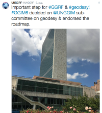
IAG welcomes the Sub-Committee
“The International Association of Geodesy (IAG) welcomes and unreservedly appreciates the establishment of a United Nations Sub-Committee on Geodesy. This advancement will augment the impacts of geodesy on the political level as well as its visibility in society. IAG and its Global Geodetic Observing System (GGOS) as promoting geodetic science and coordinating the international geodetic services will strongly support the new Sub-Committee whenever necessary and wherever possible,” says prof. Dr. Dr. h.c. Harald Schuh, president of the IAG.
At the UN-GGIM sixth session in New York, the member states did also endorse the Roadmap for the Global Geodetic Reference Frame as a principle based briefing document for national governments. The Roadmap aims to enhance the GGRF and make it more sustainable.
Geodesy has top priority
The global geodetic reference frame was among the highlights at the UN-GGIM session where 260 delegates from 86 Member States participated.
The Fijian Minister for Land and Mineral Resources, Mereseini Vuniwaqa, was key note speaker at a UN-GGIM Side Event on the Global Geodetic Reference Frame. Fiji led the adoption on the UN resolution on GGRF at the General Assembly, 26 February 2015.
“This resolution calls for more cooperation, and we are pleased to see that the Working Group has come up with the Roadmap on GGRF so quickly. The implementation of the Roadmap has top priority”, said the Minister.
Close cooperation
The engagement from the Fijian minister was welcomed by co-chair Gary Johnston:
“The development of the implementation plan will require close cooperation between National Mapping Agencies, Space Agencies, IAG, FIG and other interested research institutions. Collectively we have an opportunity to utilise the momentum that has been created within UN-GGIM to establish a better future for the global geodetic community, and for our society which relies on our products and services,” said Johnston.
Author: Anne Jørgensen
IVS School on Very Long Baseline Interferometry
IVS, 📅 Event UpdateIVS School on Very Long Baseline Interferometry
The IVS organized its 2nd training school at the Hartebeesthoek Radio Astronomy Observatory (HartRAO), South Africa, 9‒12 March 2016. The purpose of the training school was to help prepare the next generation of researchers to understand VLBI systems and inspire them in their future careers. The 45 participants included 32 students from institutions in different countries in Africa and Asia, Europe, and North America as well as 13 professionals (including postdocs) from the VLBI community and other fields of space geodesy. Participants came from Kenya (10), Zambia (9), Germany (7), Austria (4), U.S.A. (4), China (2), Finland (2), France (2), Sweden (2), Ghana (1), Italy (1), and Spain (1). Students were enrolled in M.S. and Ph.D. programs, involved in the use and analysis of VLBI data, and indeed some were second-time VLBI school attendees. Some professionals came from space agencies or geodetic research institutes (ASI, BKG, CNES, NASA) with a view to integrating VLBI into a combined analysis of space-geodetic data. A large group of attendees included students from different countries in Africa with the aim to develop expertise in geodesy and especially VLBI as part of an effort to build new stations in Africa and integrate them into the global VLBI network. We all hope this effort will come to fruition, because it will enhance the accuracy and strength of the geodetic technique and bring new groups and new countries into the VLBI community.
The thirteen lectures (18 hours and 45 minutes over four days) covered the general theory of VLBI, the technical equipment of the stations, data acquisition, data formats and data transfer, experiment scheduling and actually observing an experiment, the use of correlators, and post-correlator analysis, an introduction to geophysical modeling and analysis of VLBI data, the characterization of radio sources, and the development of celestial reference frames. The lectures were complemented with exercises on some of the presentation topics—so the participants had a chance to apply what they had been shown. The lecturers obviously spent a lot of time preparing their presentations and lectures which was highly appreciated. The lectures were recorded and will be made available on the Web, so they will be an invaluable resource for the attendees to review in coming weeks and months. For many of the attendees, the most exciting part of the VLBI school was to run the “sked” software to schedule a VLBI experiment involving Hartebeesthoek and Wettzell, and then watch Alexander Neidhardt remotely operate the Wettzell telescope via his laptop in the room with the class in South Africa, while the HartRAO 26-m (visible right outside the windows of the classroom) moved in tandem to observe the same radio sources. It gave all the attendees a demonstrable and clear sense of participation and understanding of how VLBI data are acquired.
For all the attendees at the school, the retreat format with the abundant time for interaction and discussion during the class and the coffee breaks were especially useful. It’s much easier to approach people with questions in this type of retreat format, than in a crowded conference setting such as the EGU or the AGU with their tsunami wave of attendees (10,000‒20,000 people). As a senior researcher, I found the contact and presence of the many students to be invigorating. It bodes well for the future of the discipline.
All the attendees appreciated the organization by school organizers and lecturers, and especially by the HartRAO observatory. HartRAO prepared a room with PCs where everyone could follow directly the presentations, search for reference material on the Web, or run the programs involved in the class exercises. This is a recipe that should be followed for future VLBI schools if at all possible. In the evening of the last day, after the end of astronomical twilight, the northern hemisphere attendees had the pleasure of contemplating Alpha and Beta Centauri as well as the Southern Cross in a setting devoid of light pollution, crowning a truly memorable week.
Acknowledgement. The 2nd IVS Training School was supported by HartRAO (e.g., by providing the lecture room, transportation, coffee, lunches & barbecue). MT Mechatronics (Mainz, Germany), Hat-Lab (an Istituto Nazionale di Astrofisica spin-off company), and Callisto (France/UK space communications company) provided financial support allowing the actual student participants of the school to receive a travel grant in the amount of 2900 ZAR.
[Photo caption: https://www.iugg2023berlin.org/ Attendees of the IVS Training School in front of the HartRAO 26-m radio telescope.
[Photo caption: iag_newsletter_may16_VLBIschool_IMG_2791.jpeg] In the classroom during a VLBI school exercise
Author: