• Link to LinkedIn
  • Link to Youtube
  • Link to Facebook
  • Link to Instagram
  • Link to X
  • Link to Telegram
  • Link to Behance
  • Link to Rss this site
  • Link to Mail
  • NEWS
  • EVENTS
  • JOBS
  • MEMBER
  • Sitemap
    • Home
      • NEWS
      • EVENTS
      • JOBS
      • MEMBERSHIP
    • ⭐ About Geodesy
    • 🏛️ IAG | International Association of Geodesy
      • About IAG
      • Structure
      • 🎓 ECS – Early Career Scientists
      • 🌈 IDEA – Inclusion, Diversity, Equity, Accessibility
    •   └─ Comissions
      • 1️⃣ Reference Frames
      • 2️⃣ Gravity Field
      • 3️⃣ Earth Rotation & Geodynamics
      • 4️⃣ Positioning & Applications
    •   └─ Inter Commission Committees
      • 📚 ICCT – Theory
      • 🌊 ICCM – Marine Research
      • 🌥️ ICCC – Climate Research
    •   └─ Project QuGe
    •   └─ Services
    • 🌍 GGOS | Global Geodetic Observing System
      • About GGOS
      • Structure
      • 🛰️ Observations
      • 📦 Products
      • ⚙️ Services
  • Shopping Cart Shopping Cart
    0Shopping Cart
geodesy.science - IAG website
  • GGOS
    • Home
      • NEWS
      • EVENTS
      • JOBS
      • MEMBERSHIP
    • ⭐ About Geodesy
    • 🏛️ IAG | International Association of Geodesy
      • About IAG
      • Structure
      • 🎓 ECS – Early Career Scientists
      • 🌈 IDEA – Inclusion, Diversity, Equity, Accessibility
    •   └─ Comissions
      • 1️⃣ Reference Frames
      • 2️⃣ Gravity Field
      • 3️⃣ Earth Rotation & Geodynamics
      • 4️⃣ Positioning & Applications
    •   └─ Inter Commission Committees
      • 📚 ICCT – Theory
      • 🌊 ICCM – Marine Research
      • 🌥️ ICCC – Climate Research
    •   └─ Project QuGe
    •   └─ Services
    • 🌍 GGOS | Global Geodetic Observing System
      • About GGOS
      • Structure
      • 🛰️ Observations
      • 📦 Products
      • ⚙️ Services
  • About
    • About GGOS
      • What is GGOS?
      • Why GGOS?
      • Dual Roles of GGOS
      • Vision and Mission
      • GGOS History
  • Structure
    • Governance & Leadership
      • Governing Board GB
      • Executive Committee EC
    • Coordinating Office CO
    • Science Panel
    • Bureaus
      • BNO – Networks and Observations
      • BPS – Products and Standards
    • Focus Areas
      • Geohazards Monitoring
      • Geodetic Space Weather Research
      • Artificial Intelligence for Geodesy (AI4G)
    • GGOS Affiliates
      • GGOS Japan
      • GGOS D-A-CH
      • GGOS IberAtlantic
    • GGOS Committees & Working Groups
  • Observations
  • Services
  • Products
  • Resources
    • Resources Overview
    • Outreach Materials
    • Logos & Organisation Chart
    • Reports and Articles
    • Presentations and Videos
    • GGOS Meeting Reports
    • Terms of Reference and Strategy
  • Click to open the search input field Click to open the search input field Search
Follow a manual added link
EOP Earth orientation parameter

Earth Orientation

Parameters

Official IAG-GGOS Product icon
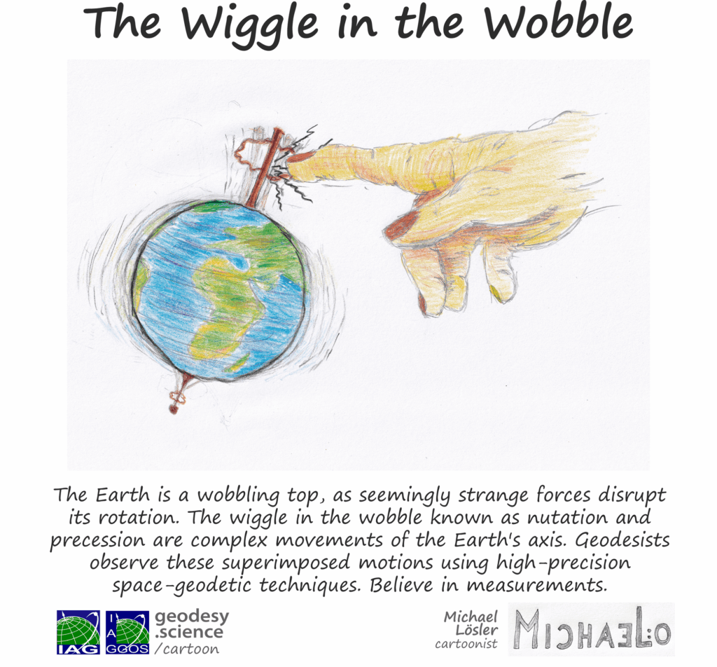
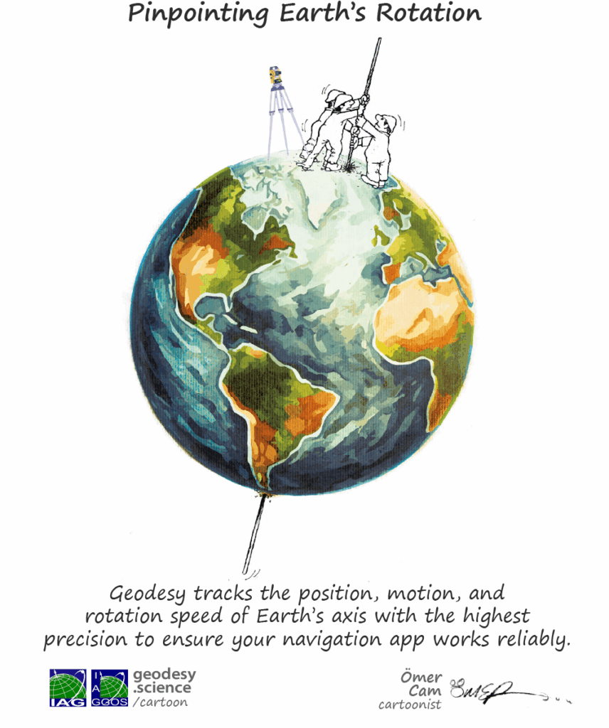
Why are days getting longer and Earth is wobbling?

The Earth Orientation Parameters (EOP) are the parameters representing the rotational part of the transformation between the current releases of the International Celestial Reference Frame (ICRF) and the International Terrestrial Reference Frame (ITRF). Accordingly, the EOP describe the change of the orientation of the Earth’s surface, on which the observatories are located, with respect to a space fixed reference frame. Earth rotation refers to the solid Earth component of the dynamic Earth system excluding deformations, such as tides and continental drift. Through interactions of individual components, angular momentum can be transferred between the atmosphere, ocean, and solid Earth, or between the Earth’s core and mantle due to the coupling mechanisms.
The following examples give an overview of the relevance of the knowledge of accurate Earth orientation parameters:

  • Realization of reference frames on Earth and in space
  • Precise positioning and satellite navigation
  • Precise orbit determination (POD)
  • Realization of time systems (e.g. monitoring of the duration of days)
  • Earth system studies (e.g. climate change)
EOP Earth orientation parameter pole rotation
© A. Verdun, University of Bern, Switzerland Info Info
EOP Earth orientation parameter pole
© A. Verdun, University of Bern, Switzerland Info Info

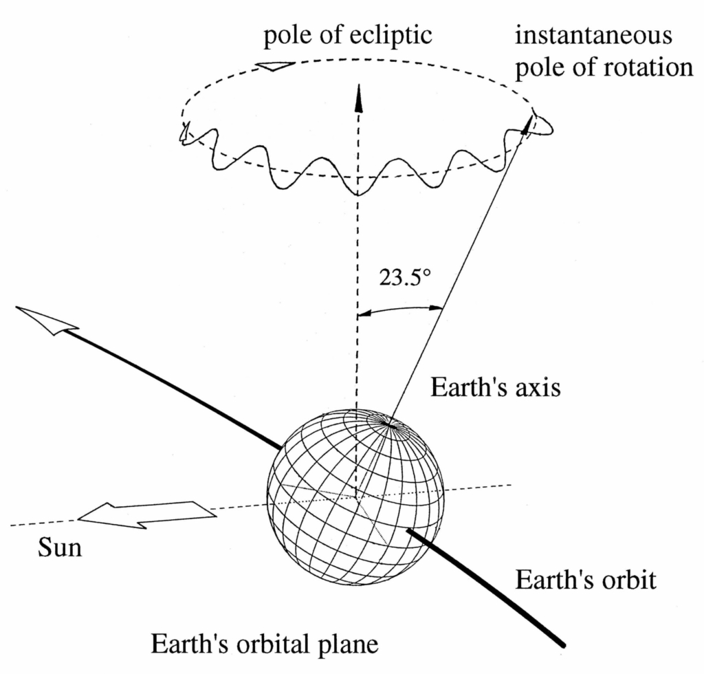
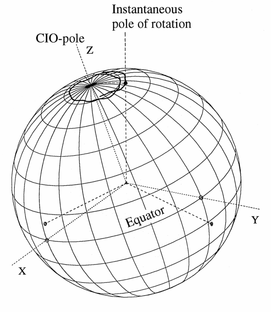
Earth orientation parameters – Precession and nutation (left) and polar motion (right)
 

Read More ...

More specifically, the EOP are a set of five time-dependent parameters that describe the difference in orientation of GCRS- and ITRS-compatible 3-vectors,

    \[ x_{ITRS}=W(x_p,y_p,s')R(ERA)Q(dX,dY,s) x_{GCRS} \]

 while maintaining their magnitudes \parallel x_{ITRS} \parallel =\parallel x_{GCRS} \parallel . The axes directions of GCRS are obtained from the positions of extra galactic objects, whereas the axes directions of ITRS are determined from coordinates of reference points of stations of space geodetic techniques on the Earth surface.

The 5 Earth Orientation Parameters are:

dX, dY - Celestial Pole Offsets (given by Precession, Nutation models)

The Corrections dX, dY (Celestial Pole Offsets – CPO) to the celestial pole coordinates (X, Y) are given by the IAU 2006 precession and IAU 2000A nutation models. Difference of the position of the rotation pole at date, the celestial intermediate pole (CIP), to the conventional celestial north pole at epoch (J2000.0) in Cartesian coordinates. Alternatively, the precession-nutation can be expressed in spherical coordinates E and d (angular units). If dX and dY are known, the celestial intermediate origin (CIO) locators can be computed with a model to sufficient accuracy. Some algorithms still use the alternative ecliptic-based paradigm and thus some authors provide the classic precession/nutation angles d\psi , d\varepsilon instead of dX, dY.

ERA - Earth Rotation Angle (related to UT1)

The ERA (unit typically in radiant) is a sidereal time expressed on the CIP equator after accounting for the CIO and Terrestrial Intermediate Origin (TIO) locations. ERA is related to the mean solar time UT1 (unit: second) through a fixed linear proportional relation to ERA. As UT1 is of high practical relevance, it is thus often reported instead of ERA.

x_p, y_p - Pole Coordinates (Polar Motion)

The pole coordinates (typically in angular unit) of the celestial intermediate pole (CIP) in the ITRS due to the polar motion (PM). The TIO locator s' is a function of the pole coordinates and their first-time derivatives and can be computed with a model to sufficient accuracy.

International Earth Rotation and Reference System Service – IERS

In this context, the terminology of rotation pole or rotation axis is specific for the diurnal revolution of the Earth (ERA), excluding the remaining smaller components of the true angular velocity. The International Earth Rotation and Reference Systems Service (IERS) is responsible for disseminating the EOP time series on operational basis derived from space geodetic techniques, including VLBI, SLR, GNSS and DORIS provided by the corresponding IAG Services, i.e., IVS, ILRS, IGS and IDS. Highly accurate CPO and UT1 are exclusively obtained by VLBI, whereas the satellite-based techniques can provide polar motion, length of day (LOD) and their first time derivatives with high precision and temporal resolution. If a sufficient number of normal points is available, LLR will be able to provide UT1 with an accuracy comparable to the VLBI results. The satellite-based techniques can refer their observations to GCRS only indirectly and in case the line of ascending node, perigee distance and inclination of the respective orbits are known.

Data Sources

  • IERS

    International Earth Rotation and Reference Systems Service (IERS)

  • IERS Earth Orientation Centre

    The IERS Earth Orientation Centre is responsible for monitoring of long-term EOP, publications of time dissemination and leap second announcements. It is located at the Observatoire de Paris in France

  • IERS Rapid Service/Prediction Centre

    The IERS Rapid Service/Prediction Centre is responsible for providing predicted EOP and measured EOP at a rapid turnaround basis, primarily for real-time users and others needing EOP information more rapidly. It is located at the United States Naval Observatory (USNO) in Washington D.C., USA.

Further Information

  • IERS Conventions (2010). Gérard Petit and Brian Luzum (eds.). (IERS Technical Note ; 36) Frankfurt am Main: Verlag des Bundesamts für Kartographie und Geodäsie, 2010. 179 pp., ISBN 3-89888-989-6

© GGOS (Prepared by: R. Heinkelmann, J. Chen, J. Ferrandiz)

Share this Product

  • Facebook Facebook Share on Facebook
  • X-twitter X-twitter Share on X
  • Whatsapp Whatsapp Share on WhatsApp
  • Pinterest Pinterest Share on Pinterest
  • Linkedin Linkedin Share on LinkedIn
  • Mail Mail Share by Mail

PRODUCTS

Reference Frames

  • © TheNounProject (edited by GGOS)
    Height Reference Frame
  • ICRF celestial© TheNounProject (edited by GGOS)
    Celestial Reference Frame
  • © TheNounProject (edited by GGOS)
    Gravity Reference Frame
  • © TheNounProject (edited by GGOS)
    Terrestrial Reference Frame

Earth Orientation

  • EOP Earth orientation parameter© TheNounProject (edited by GGOS)
    Earth Orientation Parameters

Geometry

  • © TheNounProject (edited by GGOS)
    Surface Deformation Models
  • © TheNounProject (edited by GGOS)
    Ocean Topography Models
  • © TheNounProject (edited by GGOS)
    Sea Level Change
  • © TheNounProject (edited by GGOS)
    Digital Elevation Model
  • © TheNounProject (edited by GGOS)
    Ice Sheets & Glaciers – Variations
  • © TheNounProject (edited by GGOS)
    Station Positions & Variations
  • © TheNounProject (edited by GGOS)
    Tide Gauge Records
  • © TheNounProject (edited by GGOS)
    Sea Surface Heights

Gravity Field

  • © TheNounProject (edited by GGOS)
    Global Gravity Field – Models
  • © TheNounProject (edited by GGOS)
    Gravity Field – Temporal Variations
  • © TheNounProject (edited by GGOS)
    Terrestrial Gravity Data
  • © TheNounProject (edited by GGOS)
    Regional / Local Geoid Models
  • © TheNounProject (edited by GGOS)
    Ice Sheets & Glaciers – Variations
  • © TheNounProject (edited by GGOS)
    Height Systems

Positioning & Applications

  • ICON Atmosphere© TheNounProject (edited by GGOS)
    Thermosphere
  • ICON Atmosphere© TheNounProject (edited by GGOS)
    Ionosphere
  • ICON Atmosphere© TheNounProject (edited by GGOS)
    Lower Neutral Atmosphere
  • ICON Atmosphere© TheNounProject (edited by GGOS)
    Atmospheric Products
  • GNSS Orbits satellites GPS GLONASS Galileo BeiDou QZSS IRNSS© TheNounProject (edited by GGOS)
    GNSS Satellite Orbits and Clocks

IAG as part of the IUGG

  
The International Association of Geodesy (IAG)  is a constituent association of the International Union of Geodesy and Geophysics (IUGG).

IAG Related Organisations

IAG collaborates closely with numerous organizations within geodesy and beyond. See the list for details.

Sitemap

  • Home | geodesy.science
  • ⠀└─ 📰News
  • ⠀└─ 📅 Events
  • ⠀└─ 💼 Jobs
  • ⠀└─ 👥 Membership
  • ⭐ About Geodesy
  • 🏛️ IAG | Int. Association of Geodesy
  • ⠀└─ ➡️ Commissions:
  • ⠀⠀◻️ 1 – Reference Frames
  • ⠀⠀◻️ 2 – Gravity Field
  • ⠀⠀◻️ 3 – Earth Rotation & Geodynamics
  • ⠀⠀◻️ 4 – Positioning and Applications
  • ⠀└─ 🔀 Inter Commission Committees:
  • ⠀⠀◻️ ICCT – Theory
  • ⠀⠀◻️ ICCM – Marine Research
  • ⠀⠀◻️ ICCC – Climate Research
  • ⠀└─ ⏰ Project QuGe
  • ⠀└─ ⚙️ IAG Services
  •  🌎 GGOS | Observing System
  • ⠀└─ About GGOS
  • ⠀└─ Structure
  • ⠀└─ Observations
  • ⠀└─ Products
  • ⠀└─ Services

References

Geodesy Glossary

Media Library

IAG Cloud | Public Documents

Terms of Use / Privacy Policy

IAG Statutes

IAG By-laws

Contact Us

Contact

Follow Us

LinkedIn

BlueSky

X (Twitter)

Facebook

Instagram

YouTube

Telegram

RSS Feed

Mailing List

This website is provided by the IAG Secretariat and the GGOS Coordinating Office, which are hosted by the BEV – Federal Office of Metrology and Surveying (Bundesamt für Eich- und Vermessungswesen) in Vienna, Austria.

Website Language Translation

The primary language of this website is English – however, the integrated GTranslate tool enables automatic translation into several languages:

Please note that translations into other languages may not be accurate. For reliable information, refer to the English version of the website.

2026 © Copyright | IAG - International Association of Geodesy
  • Link to LinkedIn
  • Link to Youtube
  • Link to Facebook
  • Link to Instagram
  • Link to X
  • Link to Telegram
  • Link to Behance
  • Link to Rss this site
  • Link to Mail
Scroll to top Scroll to top Scroll to top
Accessibility Adjustments

Powered by OneTap

How long do you want to hide the toolbar?
Hide Toolbar Duration
Select your accessibility profile
Vision Impaired Mode
Enhances website's visuals
Seizure Safe Profile
Clear flashes & reduces color
ADHD Friendly Mode
Focused browsing, distraction-free
Blindness Mode
Reduces distractions, improves focus
Epilepsy Safe Mode
Dims colors and stops blinking
Content Modules
Font Size

Default

Line Height

Default

Color Modules
Orientation Modules